Lane Cove Local Planning Panel 7 March 2023

A G E N D A


Logo Watermark


Agenda

Lane Cove Local Planning Panel Meeting

7 March 2023  


LC_WebBanner


Notice of Meeting


Dear Panel Members,


Notice is given of the Lane Cove Local Planning Panel Meeting, to be held in the Council Chambers  on Tuesday 7 March 2023 commencing at 5pm. The business to be transacted at the meeting is included in this business paper.


Yours faithfully

Craig - GM

Craig Wrightson

General Manager


Lane Cove Local Planning Panel Meeting Procedures


The Lane Cove Local Planning Panel (LCLPP) meeting is chaired by The Hon David Lloyd QC or alternate Chairs Mr Mark Gifford or Ms Louise Byrne. The meetings and other procedures of the Panel will be undertaken in accordance with the Lane Cove Lane Cove Local Planning Panel Charter and any guidelines issued by the General Manager.

The order of business is listed in the Agenda on the next page. That order will be followed unless the Panel resolves to modify the order at the meeting. This may occur for example where the members of the public in attendance are interested in specific items on the agenda.

Members of the public may address the Panel for a maximum of 3 minutes. All persons wishing to address the Panel must register prior to the meeting by contacting Council’s Office Manager – Environmental Services on 9911 3611. Speakers must address the Chair and speakers and Panel Members will not enter into general debate. Where there are a large number of objectors with a common interest, the Panel may, in its absolute discretion, hear a representative of those persons.

Minutes of LCLPP meetings are published on Council’s website www.lanecove.nsw.gov.au as soon as practicable following the meeting. If you have any enquiries or wish to obtain information in relation to LCLPP, please contact Council’s Office Manager – Environmental Services on 9911 3611.

Please note meetings held in the Council Chambers are Webcast. Webcasting allows the community to view proceedings from a computer without the need to attend the meeting. The webcast will include vision and audio of members of the public that speak. Please ensure while speaking to the Panel that you are respectful to other people and use appropriate language. Lane Cove Council accepts no liability for any defamatory or offensive remarks made during the course of these meetings.

The audio from these meetings is also recorded for the purposes of verifying the accuracy of the minutes and the recordings are not disclosed to any third party under the Government Information (Public Access) Act 2009, except as allowed under section 18(1) or section 19(1) of the PPIP Act, or where Council is compelled to do so by court order, warrant or subpoena or by any other legislation.


DECLARATIONS OF INTEREST


APOLOGIES


NOTICE OF WEBCASTING OF MEETING


Lane Cove Local Planning Panel Reports


1.       1a - 3 Bridge Street, Lane Cove.


Lane Cove Local Planning Panel Meeting 07 March 2023

1a - 3 Bridge Street, Lane Cove.


Subject:          1a - 3 Bridge Street, Lane Cove.    

Record No:    DA22/148-01 - 3442/23

Division:         Environmental Services Division

Author(s):      Andrew Bland 


DA Number

Council Reference: DA148/2022

Portal Reference: PAN-283584


Proposed Development

The demolition of existing structures and construction of a multi unit development consisting of 5 units over basement parking and strata subdivision.

Street Address

1A – 3 Bridge Street, Lane Cove.

Applicant/Owner

Applicant: Constantine Intay

Owner: Michael Jury and Danielle Martin


Date of DA Lodgment

1 December 2022

Development Cost

$3,019,905.33


Public Notification Period

Notification Period: 2 December 2022 to 18 December 2022


Submissions Received

10 submissions received.


Recommendation

Refusal

Local Planning Panel Referral Criteria (Schedule 1 of Planning Direction)

·    10 Submissions: The proposed application must be determined by the Lane Cove Planning Panel as 10 unique submissions have been received.

List of relevant s4.15(1)(a) matters


·    relevant environmental planning instruments


-     SEPP (Biodiversity and Conservation) 2021;

-     SEPP(Resilience and hazards) 2021;

-     SEPP (Building Sustainability Index) 2004;

-     Lane Cove Local Environmental Plan 2009.


·    relevant development control plan


-     Lane Cove Development Control Plan 2010


Summary of key submissions

·    Tree removal and the loss of the key landscaping feature of the site

·    Concerns with the third storey element / roof top terrace

·    Amenity impacts on privacy and solar access

·    Concerns regarding the level of excavation required


Report prepared by

Andrew Bland

Report date

21 February 2023


Description of the proposal to appear on determination

Development Application recommended for Refusal for the demolition of existing structures and construction of a multi unit development consisting of 5 units over basement parking and strata subdivision.

Zone

R3 Medium Density Residential

Is the proposal permissible within the zone

Yes

Is the property a heritage item

No

Is the property within a conservation area

No

Is the property adjacent to bushland

No

BCA Classification

Class 2 and 7a as there is a basement carpark underneath the proposed Units.

Stop the Clock used

No

Notification

Notified in accordance with Council policy and 10 submissions were received.                       


EXECUTIVE SUMMARY


Council received DA 148/2022 On 01 December 2022, for the demolition of existing structures and construction of a multi unit development consisting of 5 units over basement parking and strata subdivision.


This was following the discontinuance of DA 169/201 from the Court Appeal 2022/00143671 (the ‘Appeal’) in the Land and Environment Court of NSW for the same site.


The proposed development application failed to address the reasons for refusal and contentions raised in the Appeal. The contentions included information which has been requested during both the initial DA169.2021 and during the Appeal.


The additional documentation received for the subject DA is either incomplete documentation which has restrained Council from conducting a complete assessment of the proposed development and/or documentation which pursues a development which does not address Council’s concerns.


It is recommended that DA 148/2021 be refused by the Lane Cove Planning Panel for the reasons outlined in the report and recommendation.


SITE

Property

Lot. 4, DP. 20092

Lot A, DP. 36494

Area

1,391.3sqm

Site location

The site is located on the north side of Bridge street approximately 100m from Burns Bay Road.

Existing improvements

Existing improvements include 2 single storey dwelling houses, both with an integrated garage and an attached carport.

Shape

Irregular

Dimensions

31.09m - Southern side (front boundary along Bridge Street) 

38.75m – Eastern Side (side boundary with 1 & 1B Bridge Street)

33.46m – Northern side (rear boundary)

51.10m – Western side (side boundary with 5 Bridge Street)

Adjoining properties

Adjoining properties include the following:

- 2 storey townhouse development at 1 – 1B Bridge Street (R3 Zone)

- 2 storey detached multi dwelling housing at 5 Bridge Street (R3 Zone)

- 2 storey residential flat building at 88 - 90 Burns Bay Road (R4 Zone)

- Single and 2 storey dwelling houses across the road (R2 Zone)


Figure 1: Site context Source: Nearmaps


PREVIOUS APPROVALS/HISTORY


DA169/2021 History -


On 18 November 2021, the development application was lodged with Council seeking consent for development described on the Development Application Form as demolition of existing structures and proposed multi-unit dwelling” containing 6 dwellings.


Council had many concerns with the proposal and required critical information that had not been provided. The Applicant failed to address Council’s concerns or provide the information required.


On 12 April 2022, Council refused the development application for the following reasons (as set out in its Notice of Determination of the same date and excluding the “particulars” provided):

1. The proposed development does not meet the aims of Lane Cove Local Environmental Plan 2009.

2. The proposed development does not meet the objectives of the Zone R3 Medium Density Residential of the Lane Cove Local Environmental Plan 2009.

3. The proposed development does not meet the minimum area requirements for landscaping and deep soil and includes excessive tree removal and the removal of a significant tree which is capable of retention.

4. The proposed development does not achieve acceptable amenity for both the proposed and adjoining dwellings.

5. The proposed development does not comply with the Council’s storey requirements and proposes an unreasonable building design.

6. The proposed development does not satisfy the provisions of SEPP (Resilience and Hazards) 2021.

7. The proposal does not include adequate information to make an assessment.


On 18 May 2022, the Applicant commenced proceedings in Class 1 of the Land and Environment Court’s jurisdiction appealing against Council’s refusal of the development application.


During the proceeding the Applicant amended the proposal to reduce the number of Units from 6 to 5 and removed the roof top terraces from Units 4 and 5 at the rear of the site. Critical information had still not been provided and Council’s contentions had not been addressed.


On 07 November 2022, Council received a notice of discontinuance as the proposal was withdrawn from the Land and Environment Court.


DA148/2022


On 01 December 2022, the subject development application was lodged with the Council seeking consent for development described on the Development Application Form as Proposed demolition of existing structures and construction of a multi unit development consisting of 5 units over basement parking and strata subdivision containing 5 dwellings.


The key amendments included the inclusion of onsite basement waste collection, the deletion of the rooftop terraces at Unit 4 and 5, the retention of trees 4, 15, 15a and 16 (neighbouring tree) and minor amendments to the layout of Unit 5.


The subject development application was additionally accompanied by a remediation action plan, incomplete landscaping documentation, incomplete solar access assessment plans and root mapping.


PROPOSAL


Basement Level:

-     5 separate garages, each accommodating 2 parking spaces, storage (except Unit 5), laundry, lift lobby and staircases, with Unit 4 accommodating 1 accessible adaptable parking space.

-     2 visitor parking spaces, with one space being accessible and the other doubling as a car wash bay.

-     2 bicycle racks and 1 motorcycle space.

-     Plant room.

-     Fire stairs and platform lift for visitors.

-     Garbage store and loading bay for on-site bin collection.

-     Vehicular access is provided off Bridge Street from the south-western corner of the site.


Ground Floor:

-     Entry foyer, lift, combined open plan kitchen, living and dining area, 1 bedroom and 1 bathroom (being a powder room in Units 1-3 and 5 and a full bathroom in Unit 4) in each of the 5 units. Unit 5 also includes a study room.

-     Private open space for each of the 5 units.

-     Pedestrian ramp providing access to Units 4 and 5 within the western side boundary setback.

-     Pedestrian access to Units 1-3 direct from Bridge Street.


First Floor:

(i) Each unit provides 3 bedrooms (master bedroom with walk-in robe and ensuite), common bathroom and lift.

(ii) Units 1-3 provide a study nook, while Unit 4 has an upstairs sitting room.


Second Floor (Third storey):

(i) Rooftop terrace for Units 1 - 3 with stair and lift access, with the previously proposed rooftop terrace on Units 4-5 having been deleted.


Tree removal and landscaping:

(i) All trees are proposed to be removed on site with the exception of T4, T15 and T15a.

(ii) T1 and T17 located within the road reserve are proposed to be retained.


Strata subdivision:

Stratum subdivision as indicated on the strata subdivision plans. This would comprise of 5 private lots including the basement level and a common area for the driveway and the access path for the Units 4 and 5 at the rear.


PROPOSAL DATA/POLICY COMPLIANCE


SECTION 4.15 ASSESSMENT


The following assessment is provided against the relevant provisions of Section 4.15 of the Environmental Planning and Assessment Act, 1979:


Section 4.15 Matters for Consideration


(a)  The provisions of:-


(i)         Any environmental planning instrument:


SEPP (Resilience and Hazards) 2021 – Chapter 4


The provisions of SEPP Resilience and Hazards 2021 requires Council to consider the potential for a site to be contaminated. Council received a Detailed Site Investigation (DSI) report and a Remedial Action Plan (RAP). These provide a strategy for dealing with contamination. Whilst this addresses the relevant matters under the under SEPP (Resilience and Hazards), Council does not agree with the proposed method of dealing with the contamination. The RAP recommends that excavation of the site would be the optimal method of remediating the site on the basis that excavation is already proposed for the construction of the basement. Council does not support the excavation as it would result in the removal of Tree 12 and 13. Alternate methods of remediation should be considered which enables Tree 12 and 13 to be protected. See reasons for refusal.


SEPP (Biodiversity and Conservation) 2021


The subject site is within the area to which the SEPP (Biodiversity and Conservation) 2021 applies. An amended stormwater management system would ensure a neutral or beneficial impact on the quality of water entering the waterways. Refer to the Part O Assessment in the referral Table for further detail.  The proposed development would have no impacts on access to the waterways and can’t be seen from the Harbour. The proposed works therefore would meet the objectives of the plan and the requirements of the associated DCP.


State Environmental Planning Policy (Building Sustainability Index: BASIX) 2004


A BASIX certificate (certificate number: 1254498M_02) has been submitted which demonstrates compliance with the provisions of the SEPP and is consistent with the commitments identified in the application documentation.  A standard condition could be included requiring compliance with this BASIX certificate. The proposal would be considered satisfactory with respect to SEPP (BASIX) 2004.


Lane Cove Local Environmental Plan 2009


Permissibility: The subject site is zoned R3 High Density Residential under LCLEP 2009 as shown in Figure 2 below. Multi dwelling housing is permitted with consent in the zone:


multi dwelling housing means 3 or more dwellings (whether attached or detached) on one lot of land, each with access at ground level, but does not include a residential flat building.


The proposal meets with the above definition and is therefore permissible under the LCLEP 2009.


Figure 2: Site Zoning- R3 Medium Density Residential Source: ePlanning Spatial Viewer


The Council LEP2009 Zone R3: Medium Density Residential objectives are stated as:


•  To ensure that landscaping is maintained and enhanced as a major element in the residential environment.


The proposal does not maintain or enhance the major existing landscaping elements of the site being Tree 12 and 13. Council’s Tree Assessment Officer has advised that the retention of other trees has not been demonstrated given the ambiguous level of excavation proposed in proximity to these trees. The proposal would remove a major proportion of the canopy, primarily through the removal of Tree 12. See figure 3.


Figure 3: Site canopy Source: Nearmaps


The Council LEP2009 Zone R3: Medium Density Residential objectives are stated as:


•  To encourage the erection of buildings that are designed in response to the characteristics of the site and locality.


Tree 12 is considered a significant specimen due to its species (endemic to the area), health and its contribution to the sites canopy. This tree can be seen from the street and many of the adjoining properties. The proposed development is not designed in response to this tree, being the predominant characteristic of the site and locality.


A more tactical design could ensure the retention of Tree 12 and contribute positively to the amenity of both the site and the locality. This was highlighted to the Applicant by Council and any meaningful attempts to retain the tree were not considered. Council recommended root mapping be done to better understand the root structure and a developable area within the limitations of the site. Incomplete root mapping was provided.


Subdivision The proposal includes strata subdivision of the multi dwelling housing development into 5 lots (1 lot per unit).


Development Standards The proposal has been assessed against the applicable development standards within LCLEP 2009 as detailed in the following table of compliance:


Lane Cove LEP 2009

Proposal

Compliance

4.3 Height

9.5m

9.25m – Unit 1 has the highest point from existing ground level.

Yes

4.4 FSR

0.7:1 (974m2)

0.63:1 (877.4m2)

Yes


(ii)        Any proposed instrument (Draft LEP, Planning Proposal)


There are no relevant Draft Environmental Planning Instruments for the subject site.


Lane Cove DCP 2010


A full assessment of the proposal under DCP 2010 is illustrated in the following compliance table. The non-compliances identified in the table are assessed below.


DCP Control

Proposed

Complies

PART B – GENERAL

B3 Site Amalgamation & Isolated site: The proposed development will not result in the isolation of adjoining sites as these are already developed into a multi dwelling housing development. The proposed site amalgamation is reasonable.

B.6 Environmental Management

6.1 Sunlight to Public Spaces

a) New development must allow for a minimum of 2 hours of solar access to at least 50% of new and existing public open areas or plazas between the hours of 11am and 2pm on 21st June.

Not applicable – site does not adjoin public open space or plaza.

N/A

6.3 Energy and Water Efficiency for Buildings

a)  Incorporate passive solar design techniques to optimise heat storage within the building in winter and heat transfer in summer.

Basix provided

Yes

B.8 Safety and Security

a) Ensure that the building design allows for casual surveillance of access ways, entries and driveways.

Each dwelling has proviced casual surveillance due to the orientation to the street of each dwelling.


Yes

8.1 Activation

8.1.1 General

a) Development is to be well connected to the street and contribute to the accessibility of the public domain

The street front dwellings have separate access paths to the front porch. 

The rear dwellings share an access path next to the driveway ramp.

Yes

All development is to face the street and/or public open spaces and provide uses at ground level that provide activity.

The front 3 dwellings face the street.


Yes

8.1.2 Residential development

a)         All ground floor apartments, villas, townhouses and attached or detached dwellings that have a street frontage other than battle axe blocks are to have direct access or entries from the street and at least one habitable room with windows facing the street.

All street front dwellings have a window facing the street from a habitable room.

Yes

8.2 Passive Surveillance

a) All development at ground level is to offer passive surveillance for safety and security of residents and visitors.

Passive surveillance provided with one habitable room addressing the street.

Yes

PART C RESIDENTIAL DEVELOPMENT

C2 Attached Dwellings and Multi-Dwelling Housing

2.2 Site Area and Frontage

a) Attached dwelling and multi-dwelling housing proposals require:

I. A minimum site area of 1,000m² per development; and

II. A minimum site width at the front building line of 20m.


Total site: 1,391.3m²


Bridge Street Frontage: 31.09m


Yes


Yes

c) An average site area 250sqm per attached dwelling or multi-dwelling unit (including common areas) is required.

Total Area: 1,391.3m² / 250m² = 5.5652 dwellings allowable onsite

The site has an average of 278.26sqm for each lot.


Approxmiate calcautions

Unit 1 - 226

Unit 2 - 202

Unit 3 - 228

Unit 4 – 271

Unit 5 – 230

Access ways - 211

Yes

2.3 Streetscape

a) New buildings are to recognise and respond to the lot pattern and rhythm of dwellings within the street.

Development is consistent with lot pattern and streetscape.

Yes

b) Dwellings are not to be positioned over driveways to basement car park where this results in an unacceptable impact on the visual amenity and continuity of the streetscape.

No dwellings are positioned above the basement driveway.

Yes

2.4 Setbacks

2.4.1 Street setback

This is also the front setback for the dwelling addressing the street.

a)   It is to be a minimum of 6.0m.

All dwellings have 6m front setbacks.

Yes

2.4.2 Front setback:

a) A minimum of 2.0m for the dwellings within the development (refer to Diagram No. 7).

The rear dwellings are setback 3m.

Yes

b) Basement car parks are not to extend beyond the building envelope into the front setback.

Basement car park does not extend into front setback area.

Yes

2.4.3 Side setback

b) A minimum of 1.5m for a two storey dwelling.

1.5m side setback provided.

Yes


2.4.4 Rear setback

This refers to setbacks from both, the site rear boundary and dwellings within a development.

a) A minimum of 3.0m

All dwellings setback 3m.


Yes


2.5 Fences

The provisions for fences in the dwelling house section shall apply – refer Part C.1 of this DCP for provisions regarding fencing:

1.4 Fences

1.4.1 Front fences

Solid fences

a) permitted up to 900mm above ground level (existing) on the front boundary.

The plans indicate that there would be no front fencing other than a minor retaining wall for unit 3.

Yes

Part solid and predominantly see through fences

b) permitted up to 1200mm above ground level (existing) on the front boundary.

N/A


N/A


c) permitted up to 1800mm above ground level (existing) setback at least 1m from the front boundary with the solid portion no higher than 600mm.

N/A

N/A

d) for the see through portion, the width of the spacing between palings must be at least the same as the width of the palings.

N/A

N/A

1.4.2 Side and rear fences

a) Side fences behind the building line are to be a maximum of 1.8m in height above ground level.

1.8m high colorbond fencing on concrete block retaining wall.

Yes


2.6 Landscaped Area

a) Landscaping is to relate to the ground level of the dwelling by direct access from a living area.

Direct access to POS provided through living area.

Yes

b)  A minimum of 35% of the site is to be landscaped area (deep soil) with a minimum width of 3.0m. For attached dwellings, this refers to each allotment individually.

Unit 1 – 17% (40sqm / 226sqm)

Unit 2 – 19% (39sqm / 205sqm)

Unit 3 – 20% (48sqm / 234sqm)

Unit 4 – 33% (91sqm / 245sqm)

Unit 5 – 30% (70sqm / 230sqm)


Even if the site is assessed as a whole the proposed deep soil area is non-compliant by 14% (-195sq./m)


No, see reasons for refusal.

2.7 Cut and Fill

The provisions for cut and fill in the dwelling house section shall apply.  Refer Section 1.6 of DCP Part C.1 for provisions regarding cut and fill:

1.6 Cut and Fill

a) All dwellings are to relate to the existing topography of the land at the time of the adoption of this DCP.

Up to 1.7m of cut proposed in the north east corner for Unit 5. Council’s Tree Assessment Officer states that this restricts the likelihood of being able to retain Tree 4.


Up to 1.2m of cut proposed at the rear junction of the 2 lots (the middle of the site).

No, see reasons for refusal.


b) The area of the site contained within the building footprint can be excavated or filled only where it is necessary to reasonably construct a dwelling on steeply sloping sites.

Not applicable

N/A

c) All dwellings are to adopt a split level approach to the design of the house to minimise excavation and fill and to achieve a design response that relates to the sloping topography of the site.

Not applicable.

N/A

d) Development is limited to a maximum depth of excavation or fill of 1m at any point on the site unless it is demonstrated that the site’s slope is too steep to reasonably construct a 2 storey dwelling with this extent of excavation.

The sites slope is not to steep to reasonably construct a 2 storey dwelling house.


Up to 1.7m of cut proposed to construct a part 3 storey development plus a basement.

No, see reasons for refusal.

e) In such circumstances, Council may consider increasing the depth of excavation between the underside of the lowest floor to any point on the site where:

I. large exposed undercroft areas are not created

II. the excavation does not create adverse impacts on the stability or amenity of adjoining properties or the public domain.

Excavation not supported due to the impacts on trees and neighbourhood amenity.

N/A

f) Excavation or fill is not to result in the loss of any significant mature trees within the side, front or rear boundary setbacks.

Excavation would result in the loss of the Tree 12 and 13 (mature and significant specimen).


Amended plans would retain Tree 15 and 15a located in the northwest corner of the site, following Councils request to retain more trees.


Tree 16 (tree on adjoining property) proposed to be retained after Council advised it would not be supporting tree removal on adjoining sites.


Tree 9 and 10 located at the rear of the property and located where minor excavation ~0.6m is proposed.


Tree 4 located in the north east corner of the site and located where minor excavation ~1.7m is proposed.

No, see reasons for refusal.

2.8 Building Design

a) Dwellings are to be oriented to face the street with additional dwellings oriented to follow the existing development pattern

The dwellings are appropriately orientated.

Yes

b) The architectural style of development must be sympathetic to the adjoining and surrounding buildings in terms of height, materials, roof pitch and overall building character.

Dwellings match surrounding locality.

Yes

c) Visual continuity of open space corridors and vegetation elements in the block is to be maintained by the position of buildings.

The most significant vegetation element, Tree 12, is not being maintained.

No, see reasons for refusal.

d) The area of the site devoted to driveways and vehicle turning areas should be minimised.

One driveway entry provided to the basement car park.

Yes

e) On sloping sites car parking may be located below the residential level of the dwelling.

Basement car park provided.

Yes

f) On sites with a slope in excess of 5% each dwelling is to have a separate ground floor level with the difference being equal to the average slope of the site.

Not provided – site has a gradual slope of 5.05% from the northeast corner to the southwest corner.

No, see reasons for refusal.

g) Side and rear facades are to be articulated to provide visual interest using windows, awnings, sun shading devices, upper storey setbacks or insets within the wall alignment.

Adequate articulation along the side and rear facades has been provided.

Yes

h) A mix of building materials and/or colours should be used to reduce the appearance of bulk and to integrate the buildings within the local area.

Acceptable colours and finishes schedule has been provided.

Yes

i) Height

I. The maximum number of storeys for attached dwellings or townhouses in the R3 zone is 2 storey

II. The maximum number of storeys for a villa is 1 storey.

III. The minimum floor to ceiling height on ground floor is to be 2.7m and upper level(s) 2.4m.


Units 1, 2 and 3 - A basement level for parking, 2 storeys of habitable living and a trafficable roof top terrace. (3 storey plus a basement)

N/A


3m ground floor proposed

2.7m top floor proposed.


No, see reasons for refusal.


N/A


Yes

j) The minimum dwelling width is 5m (measured between the external walls).

Dwellings are 6.9m-9.3m in width.

Yes

2.9 Amenity

2.9.1 Privacy

a) Development should be located and oriented to maximise visual and acoustic privacy between buildings.

Dwellings have been orientated to maximise visual and acoustic privacy other than the roof top terrace.


Roof top terrace is likely to create visual and acoustic privacy issues for both the proposed development and neighbouring properties.

Yes


No, see reasons for refusal.


b) Building elements such as balconies and decks are to be designed to minimise overlooking of living areas and private open spaces of adjoining dwellings.

The dwellings have their living rooms and patios at ground floor level to reduce privacy impacts.

Yes

c) The windows of dwellings are to be located so they do not provide direct and close views into the windows of other dwellings, particularly those of living areas.

Provided.

Yes

Separation requirements within development:   N/A

g) Council will require a report by an acoustic consultant to be submitted with development applications for multi dwelling housing developments on sites adjacent to noise generating sources such as major roads and rail corridors (see Part B – General Controls for provisions regarding development near busy roads and rail corridors).

Not applicable – Bridge Street is not classed as major roads.

N/A

h) Internal habitable rooms of dwellings affected by high levels of external noise are to be designed to achieve internal noise levels of no greater than 50dBA.

Internal habitable rooms are not subjected to any high level noise generating sources.


N/A

2.9.2 Solar Access

a) Dwellings within the development site and any residential development beyond the site are to receive a minimum of 3 hours sunlight to habitable rooms and to at least 50% of the private open space between 9am and 3pm on 21 June.

Living room:


Unit 1 – 5 Hours

Unit 2 – 6 hours

Unit 3 – 5 hours

Unit 4 – 4 hours

Unit 5 – No hours


Private open space:


Unit 1 – 5 Hours

Unit 2 – 3 hours

Unit 3 – 3 hours

Unit 4 – 4 hours

Unit 5 – No hours

No, see reasons for refusal.

Surrounding Development:

The proposed cover on the entry ramp to the garage basement would reduce the solar access at 1/5 Bridge Street for the primary kitchen and living area. See Figure 4 below which shows these windows and refer to drawings numbered DA-452 and DA-453 provided in the architectural set for the sunseye diagram.

The reduction would be from 4 hours to 1 hour.

Figure 4: Impacted room at 1/5 Bridge Street. (Source: Town Planner)

No, see reasons for refusal.

d)  Where existing development currently receives less sunlight than this requirement, this should not be unreasonably reduced. Shadow diagrams are required with development applications to show solar access and the extent of overshadowing.

Noted.

Noted.

2.9.3 Private and Communal Open Space

a)  Private open space is to be:


I.   Directly accessible from the living area of the dwelling.


II.  Located so as to maximise solar access.


III. A minimum of 4.0m dimension in any direction.


IV. A minimum unbuilt upon area of 50m² per 2 or 3 bedroom dwelling.


I. All dwellings have POS accessible from a living area.


II. Achieved where possible for Units 1 – 4.

Unit 5 does not receive solar access.


III. Provided for all units


IV.

Unit 1 – 65sqm in rear yard

Unit 2 – 75sqm in rear yard

Unit 3 – 61sqm in rear yard

Unit 4 – 63 in rear yard

Unit 5 – 54 in the rear yard


Yes


No, see reasons for refusal.


Yes


Yes

Yes

Yes

Yes

Yes

b) Private open space may be located on top of semi-basement parking. (Garage and carport roofs are to be non-trafficable).

POS located on top of the basement level parking for units 1, 2 and 3.

Yes

c) Private open space is to contain paving of at least 10m² per dwelling.

Unit 1 – Provided

Unit 2 – Provided

Unit 3 – Provided

Unit 4 – Provided, however there is conjecture over it being built in the same location as the retained Tree 15.

Unit 5 – Configuration of paving responds the alignment with the boundary fence.

Yes

Yes

Yes


Yes


Yes


d) Private open space will not be permitted in the front setback area.

Court yards proposed at front but POS located in rear yards.

Yes

e) Communal open space is to be provided for a development of more than 5 townhouses or villas.

Not required.

N/A

2.10 Number of Car Parking, Motorcycle and Bicycle Spaces

a) Garage and carport roofs are to be non-trafficable.

Basement car park proposed.

N/A

b) Semi-basement parking may protrude up to a maximum of 1.2m above the ground level (existing) subject to achieving a high quality design solution where ventilation grilles are not located to front or rear gardens.

Basement parking would no protrude ground level.

Yes

c) Driveway widths are to be kept to a minimum while complying with AS 2890.1 and AS2890.2.

Driveway widths comply.

Yes

d) A Transport and Accessibility Report may be required by the Traffic Manager.

Traffic and Parking Impact Assessment has been provided with the application.

Yes


Part F - Access and Mobility


PART F - ACCESS AND MOBILITY

DCP Controls

Proposal

Complies

3.5 Adaptable and Visitable Housing (residential flats and dual occupancies)

Adaptable housing to be provided at the rate of 20% of all dwellings in a Class 2 development.

Unit 4

Yes

Dwellings are to be visitable at the rate of 80% in developments requiring adaptable housing.

Provided

Yes

3.8 Access to, and within, buildings

1.  Access is to be provided in accordance with BCA Clause D3.1 and in accordance with Table 1:

-    RFB/Townhouse 2;

-    Car park Class 7a

From a required accessible entrance to at least 1 floor containing SOU’s and to the entrance doorway of each SOU on that level. To and within 1 of each type of room or space for use in common by the building occupants


Yes

Yes


2. Access is to comply with the relevant Provisions of the BCA, and associated referenced Australian Standards. Demonstration is required in the form of an access report prepared by a suitably qualified access consultant as part of the DA documentation.

Yes

Yes


Part R – Traffic, Transport and Parking


PART R TRAFFIC, TRANSPORT AND PARKING

Development Control

Proposed

Complies

2.2 Car Parking Rates


Multi-Dwelling Housing


Table 1 – Car parking rates


Residents:

0.5 spaces per studio

1 space per 1-bedroom unit

1.5 spaces per 2-bedroom unit

2 spaces per 3+ bedroom unit


Required:

5 x 3 bedroom Th: 5 x 2 = 10


Provided:

18 residential spaces

Each Unit is allocated 2 parking spaces including 1 accessible space for Unit 5.


Yes

1 disabled space for each adaptable housing unit


2 adaptable TH proposed


Provided.

Yes

Visitor Parking:

1 space per 4 units

1 disabled space per 50 visitor spaces (min. 1 disabled space)

Required:

5/4 = 1.5 spaces


Provided:

2 visitor spaces

1 Disabled spot provided.

Yes

2.7 – Motorcycle parking

1 motorcycle space per 15 car spaces

Motorcycle parking spaces are to have an area of 1.2m x 3m

Only one motorcycle space provided in basement.


Amended dimesons comply.

Yes


Yes


Variations to Council’s Codes/PolicIes


The proposed variations have been indicated in the compliance table above. The non-compliances form part of the reasons for refusal. See draft reasons for refusal.


REFERRALS


Other sections of Lane Cove Development Control Plan 2010 have been addressed through referrals as outlined in the following table:


Referral

DCP

Comment

Accessibility


Part F – Access and Mobility

The accessibility report provides compliance with the current standards and DCP requirements.

Landscaping


Part J – Landscaping

Objection on the basis of tree impacts, insufficient deep soil landscaping (35% deep soil landscaping is required) as per the DCP requirements. See the full response in the section following this table.


See draft reasons for refusal.


Tree Preservation


Part J – Landscaping

Objection on the basis of the following:


-    Removal of the two large, significant, locally indigenous Eucalyptus botryoides (Bangalay) would not meet J 2.2.1.

-    Insufficient information regarding the retention of trees. See the full response in the section following this table.


See draft reasons for refusal.


Engineering


Part O – Stormwater Management

Objection on the basis of the stormwater system (connection from the pump out system in the basement) being connected to the street kerb. The system should be connected to a street drainage pit.


Waste Management


Part Q – Waste Management and Minimisation

Objection on the basis of the following:


-    The provisions for onsite bins collection have not been adequately provided on the plans or specified in the Ongoing Management Plan.

-    The gradient of the driveway is too steep as explained in the next section of this table.

-    Swept paths are required to be shown in the Waste Management Plan to show that a truck can enter and exit the site in a forward facing direction.


Traffic, Transport and Parking


Part R – Traffic, Transport and Parking

Objection on the basis that the ramp is insufficient for the following reasons:


-    The proposed entry ramp grade 1:5 (20%) exceeds the recommended grades in “AS 2890.2-2002, Table 3.2 Maximum Roadway and Ramp Grades and rates of Change of Grade”.

-    The maximum recommended grade is 1:6.5 (15.4%) with a maximum rate of change of grade of 1:12 (8.3%) over 4m.

-    It is not convincing in the Traffic Report that the vertical clearance for the proposed grades is greater than 50mm.


Building Surveyor


N/A

Objection on the basis of non-compliant design and no BCA compliance report. External openings i.e. windows and doors within 3m of the boundary must be protected in accordance with C3.4 of the BCA as the building is a class 2 and class 7a.


Environmental Health


Part B – General Controls (Part B6/B7)

Objection on the basis of insufficient information including:


-    No environmental Management Plan

-    No Construction Noise & Vibration Management Plan

-    No Construction & Demolition Waste Management Plan which is concerning regarding the potentially contaminated material.


These could be conditioned.


Tree Assessment Officer Response:


I have attended site and reviewed the supplied plans and supporting documentation.


·    The proposal requests the removal of two large, significant, locally indigenous Eucalyptus botryoides (Bangalay) from the property. Removal of these trees is not in public interest (as noted within submissions) and not in accordance with objective Part J 2.2.1 of the LCC DCP 2010.

·    The extent of excavation within the site is unclear and not consistent within the plans. For example, the applicant appears to have made attempts to retain T4 Jacaranda mimosifolia on the north eastern side of the property by altering the building and basement shape to accommodate the Structural root Zone. An FFL of 64.5 is shown within supplied plan DA-99 for unit 5 adjoining the Jacaranda. The closest RL on the edge of the SRZ of the tree towards the building is measured at 65.46, 96cm above the FFL. No retaining walls are shown on the plans suggesting there is an elevated garden bed within this area.

·    North West Elevation Plan DA-200, South West Elevation plan DA-201, Long Section DA-300, Section Driveway Ramp DA -301, Section Stair to basement DA-301 and section throughout adjoining building DA-493 all show excavation to the northern and eastern boundaries up to 1.4m in depth. This would affect the retention of trees 4, 9 and 10.

·    Figure 17, Page 27/72 of the supplied Arborist report shows pruning required for building clearance to T15, Eucalyptus botryoides. This was assessed as being greater than 30% of the canopy and may increase the likelihood of tree decline with the cumulative impacts to the root system and canopy.

·    T15 was noted as incurring a 11.93% impact to the TPZ which was identified as acceptable within the Arborist report. Section 3.3.3 of AS4970-2009 defines incursion greater than 10% as major, with the project arborist to demonstrate the trees would remain viable. As slab footing excavations are greater than 10% of the TPZ and on the cusp of the SRZ of T15, additional exploratory root excavations are required along the proposed line of the slab to demonstrate the viability of the building in this location.


The applicant is requested to provide additional information:


-     Root mapping is required to a depth of 50mm along the proposed line of the slab for unit 4 within the TPZ of T15. No roots are to be severed as part of this investigation. Please see mandatory requirements PDF.


-     Clarification from the Architect with regards to the extent of site excavation and installation of boundary retaining wall is required as it will have an affect on trees proposed for retention.


Council’s position has not changed with regards to the retention of trees 12 and 13.


Landscape Assessment Officer Response:


1.   The landscape documentation plan set does not show the entire area out to Bridge street and what is happening with all Council assets

a.   Tree protection measures for T1 & T17 are required as per the DA Landscape checklist

2.   The landscape documentation plan set has not clearly demonstrated the Proposed Tree Protection measures as per the DA Landscape Checklist

3.   The proposed development should be centred around the retention of the two large Eucalyptus botryoides, T11 & T12 (Bangalay) in the centre of the site in keeping with Lane Cove Council’s LEP and DCP

4.   There is no Development Application Landscape Checklist submitted and as a result the following critical information is missing:

a.   Sections and elevations clearly showing the relationship of the proposed landscaping with the built form.  A minimum of two sections east – west and north – south required

b.   Sections and elevations for T4, T15 7 T15A would provide valuable information on tree incursions

5.   The proposed deep soil area is non-compliant by 14% (-195sq./m) which is not acceptable and in response to the proposed removal of T11 & T12, sufficient areas for replacing these trees to their mature height and size cannot be accomplished with the proposed replacement locations of the  x Angophora costata

6.   Inadequate levels of deep soil landscaping have been provided irrespective of whether the site is calculated as a whole or per unit.

7.   The level at the base of T4 is RL 65.79 and the FFL of Unit 5 is 64.50 which would require either:

a.   a retaining wall of 1.29 in height that would need to be outside the structural root zone of T4 which is not represented or

b.   the removal of T4 in order to accommodate the proposed floor level of Unit 5,

               either way, this information is lacking and cannot therefor be assessed adequately

8.   The incursions within the TPZ’s of T15 & 15A looks to be well above the acceptable 10% for minor incursions which is unacceptable.  All trees to be retained should be left unaffected by the building footprint

9.   There is no bulk earthworks plan as per the DA Landscape checklist which clearly shows the proposed cut and fill and possible conflicts with the roots of trees to be retained

10. The levels on the landscape plan are incorrect for Units 4 & 5

11. The Architectural plans represent a 4m x 4m square area of Private Open Space, yet the landscape plans show the majority of this area as raised garden bed which will be inaccessible as Private Open Space

12. The raised planter boxes allocated to Units 1, 2, and 3 do not provide a compliant soil volume to meet the control as outlined in Part J – Landscape 1.10 Planting on Structures


(b) The likely impacts of that development, including environmental impacts on both the natural and built environments, and social and economic impacts in the locality


The impacts of the development have been considered and the impact on existing trees are not considered to be adequately addressed with the viability of retention or replacement not substantiated or supported by Council staff.


(c)  The suitability of the site for the development


The subject site is suitable for a multi dwelling house development.


(d) Any submissions made in accordance with this Act or the regulations


The proposal was notified in accordance with Council policy and 10 submissions were received. The key concerns have been encapsulated within the draft reasons for refusal in the recommendation. The key concerns have been summarised below:


- the impacts from the roof top terrace (third storey element).

- the tree removal, non-compliant landscaping and environmental impacts.

- the depth of excavation and size of the basement level parking.

- the impacts of the basement on traffic and neighbourhood amenity.

- the number of dwellings proposed.

- the dark finishes proposed for the development.

- the front setback of Units 1, 2 and 3.

- amenity impacts including solar access, light spillage and overlooking (such as overlooking from the level 1 windows into adjoining dwellings.


(e) Public Interest


The proposed development would not be within the public interest due to the impacts on neighbour amenity (specifically privacy and solar access) and the impacts on the streetscape with the out of character roof top terraces.


SECTION 7.11 ASSESSMENT


The proposal is subject to the provisions of the Lane Cove Section 7.11 (formally Section 94) Contributions Plan which levies new developments to assist in catering for the demand placed on existing Council community facilities and/or infrastructure. The Section 7.11 contribution payable is calculated in accordance with the Contributions Plan being the average number of persons per dwelling size as detailed in the following table:


No. bedrooms

Average occupancy

Amount of contribution per dwelling

No. of Dwellings

Total contribution

4 Bedrooms

3 persons

$11,529.18 x 3 = $34,587.00

Capped Rate $20,000.00 per dwelling

5 x $20,000.00

$100,000.00


TOTAL

$100,000.00


The Section 7.11 contribution payable is reduced through any existing credit applied to the existing entitlements as detailed in the following table:


No. bedrooms

Average occupancy

Amount of contribution per dwelling

No. of Dwellings

Total contribution

2+ Bedrooms

N/A

Capped Rate $20,000.00 per dwelling

2 x $20,000.00

$40,000.00


TOTAL

$40,000.00


The Section 7.11 contribution payable would be $100,000.00 - $40,000.00 = $60,000.00


CONCLUSION


The matters in relation to Section 4.15 of the Environmental Planning and Assessment Act 1979 have been assessed.


The proposal is compliant with the floor space ratio and the maximum ridge height development standard.  Whilst multi-dwelling housing developments are permitted in the zone, the layout and size of the development results in a number of non-compliances with the Lane Cove DCP 2010 and the Lane Cove LEP 2009.


The proposed tree removal would have detrimental impacts on both the natural environment and the amenity of the street scape and neighbours. The removal of Tree 12 and 13 locally indigenous trees with a high landscape amenity and ecological value, would be contrary to the objectives outlined for the R3 Medium Density Residential Zone.


The departures from the Lane Cove Development Control Plan 2010 result in unsatisfactory amenity to neighbouring properties. The lack of information does not provide the opportunity for an adequate assessment.


The proposed development cannot be supported in its current form for the reasons outlined within the report and detailed in the recommendation below. Accordingly, it is recommended for refusal.


RECOMMENDATION


That pursuant to Section 4.16(1)(b) of the Environmental Planning and Assessment Act, 1979 the Lane Cove Local Planning Panel, at its meeting of 7 March 2023, exercising the functions of Council as the consent authority, refuse Development Application DA148/2022 for the demolition of existing structures and construction of a multi-unit development consisting of 5 units over basement parking and strata 
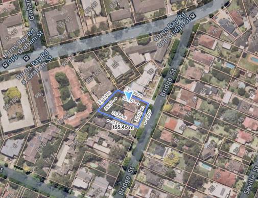
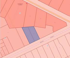
subdivision at 1A – 3 Bridge Street, Lane Cove, for the following reasons:


Tree Removal

1. The development application should be refused because it proposes excessive tree removal without adequate justification, would result in a significant loss of tree canopy on site and adversely affect the amenity of the site and locality.


Particulars


(a) The following aims set out in clause 1.2 of LCLEP 2009 are relevant:

(a) to establish, as the first land use priority, Lane Cove’s sustainability in environmental, social and economic terms, based on ecologically sustainable development, inter-generational equity, the application of the precautionary principle and the relationship of each property in Lane Cove

with its locality,

(b) to preserve and, where appropriate, improve the existing character, amenity and environmental quality of the land to which this Plan applies in accordance with the indicated expectations of the community,

(c) in relation to residential development, to provide a housing mix and density that

(ii) is compatible with the existing environmental character of the locality

…”


(b) The Land Use Table for Zone R3 Low Density Residential in LCLEP 2009 contains the following relevant objectives:

To encourage the erection of buildings that are designed in response to the characteristics of the site and locality.

To maximise the residential amenity of medium density housing in the area.

• To ensure that landscaping is maintained and enhanced as a major element in the residential environment.


(c) Section 2.1 in Part C1 of LCDCP 2010 contains the following relevant general objectives:

1 Development is compatible and complementary to the visual and environmental character of surrounding residential areas.

3 The protection of significant natural landscape features.


(d) Section 2.6 in Part C2 of LCDCP 2010 contains the following relevant objectives in relation to landscaped area:

2.6 Landscaped Area Objectives

The objectives for landscaped area are:

1 To provide privacy and amenity.

2 To retain and provide for significant vegetation, particularly large and medium sized trees and to provide continuous vegetation corridors.

3 To conserve significant natural features of the site.


(e) Section 2.7 in Part C2 of LCDCP 2010 requires reference to the cut and fill controls in Section 1.6 in Part C2. Section 1.6 contains the following relevant control:

f) Excavation or fill is not to result in the loss of any significant mature trees within the side, front or rear boundary setbacks.


(f) Section 2.8 in Part C2 of LCDCP 2010 provides the following control relating to building design:

c) Visual continuity of open space corridors and vegetation elements in the block is to be maintained by the position of buildings.


(g) Section 1.4 in Part J of LCDCP 2010 contains the following relevant objective for landscaping of new development:

3. The development should retain existing trees where reasonably possible and should not require unnecessary tree removal. Indigenous canopy trees should be provided where space permits. In particular where tree removal is required compensatory tree planting is required…


(h) Section 2.2 in Part J of LCDCP 2010 provides the following relevant objective in relation to tree preservation:

1. The retention of the maximum possible number of existing trees, particularly native trees, within the Municipality in healthy condition and natural form and shape.


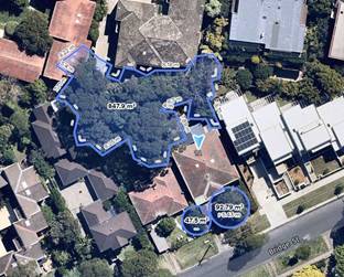
(i) Of particular concern is the proposed removal of T12 and T13, which are identified as Eucalyptus botryoides (Southern Mahogany), being a locally endemic tree to Lane Cove. These trees were found to be in good condition in the arborist report (prepared by Treehaven Environscapes, dated 31 January 2022), addendum report (prepared by Treehaven Environscapes, dated 16 March 2022) and by the Council’s arborist during an inspection on 10 February 2022.


(j) T12 and T13 have attained a height of in excess of 22m and 16m, respectively, canopy spreads of up to 15m and are highly prominent within streetscape.


(k) This loss of canopy would have an adverse impact on the amenity of the locality in terms of the outlook, vegetative screening and environmental benefits that are presently associated with the trees.


(l) The retention of the trees has not been adequately considered in the design of the proposed development,


(m) The development application seeks to retain T4, being a Jacaranda mimosifolia (Blue Jacaranda) located in the north-eastern corner of the site. The proposed excavation to reduce the existing ground level and construction of a boundary retaining wall shown on Drawing No. DA-200 “North West Elevation” (prepared by IDA Design Group, Revision C, dated 6 September 2022) would be occurring within the Tree Protection Zone and Structural Root Zone of this tree.


(n) The proposed tree removal on site including the most significant vegetative elements, being T12 and T13, and the potential need to remove T4, T15, T15A and T16 where they are impacted by the major incursions outlined above, is inconsistent with the following:


(i)     The aims of LCLEP 2009 set out above;

(ii)    The objectives of Zone R3 Medium Density Residential set out above;

(iii)   The objectives in clause 2.1 in Part C2 of LCDCP 2010 set out above;

(iv)   The objectives in Section 2.6 in Part C2 of LCDCP 2010 set out above;

(v)    Control f) in Section 1.6 in Part C2 of LCDCP 2010;

(vi)   Control c) in Section 2.8 in Part C2 of LCDCP 2010;

(vii)  Objective 3 in Section 1.4 in Part J of LCDCP 2010; and

(viii)  Objective 1 in Section 2.2 in Part J of LCDCP 2010.


Deep Soil Areas

2. The development application should be refused as the trees to be removed are not proposed to be compensated through adequate landscaping and deep soil areas on site, which is contrary to the provisions of LCDCP 2010 and will adversely affect the amenity of future occupants and the locality through a permanent loss of the tree canopy that currently exists on site.


Particulars

(a) The various provisions extracted in particulars (a)-(d) and (f) of Contention 1 above.


(b) The following additional provisions are relevant:

(i) Section 2.6 in Part C2 of LCDCP 2010 provides the following control in relation to landscaped area:

b) A minimum of 35% of the site is to be landscaped area with a minimum width of 3.0m. For attached dwellings, this refers to each allotment individually.

(ii) The terms “landscape area” and “deep soil zones” are relevantly defined for the purposes of LCDCP 2010 as follows:

Landscaped area means part of a site used for growing plants, grasses and trees, but does not include any building, structure or hard paved area.”

Deep soil zones are areas of natural ground with relatively natural soil profiles retained within a development. Buildings, basement carparks, swimming pools, tennis courts, patios and decks, and impervious surfaces such as paved areas, driveways, carparking and roofed areas are NOT

included as part of the deep soil zone.

(iii) Section 1.6 in Part J of LCDCP 2010 specifies that 35% of the site is to be landscaped area (i.e. deep soil).


(iv) Section 1.4 in Part J of LCDCP 2010 contains the following relevant objective for landscaping of new development:

12. Trees that are removed as part of the DA process must be replaced at a 1:1 ratio. Replacement trees must be able to reach the potential mature dimensions of the removed tree.

(v) The minimum standards for planting on structures are set out in Section 1.10 in Part J of LCDCP 2010.


(c) The amended landscape plans prepared by Conzept Landscape Architects (Revision C, dated 30 September 2022) indicate that deep soil areas meeting the definition of “deep soil zone” under LCDCP 2010 (i.e. with dimensions of more than 3m) represent only 21% of the site area, which falls short of the amount required under section 2.6 in Part C2 of LCDCP 2010 (and Section 1.6 in Part J of LCDCP 2010) by 14%.


(d) The landscape plans do not provide the soil volumes for the trees proposed in the central garden beds above the basement level for the purposes of confirming whether the controls in section 1.10 in Part J of LCDCP 2010 are met.


(e) Without appropriate deep soil areas, the trees that are proposed to be removed cannot be replaced with adequate compensatory planting to restore the canopy on the site.


(f) The recently approved multi dwelling housing development at 1-1B Bridge Street complies with the requirement to provide 35% of the site as landscaped area, and the approval of this development application would therefore be contrary precedent set by the adjoining development.


(g) While the proposed replacement plantings do meet the ratio of 1:1 specified in section 1.4 in Part J of LCDCP 2010, in light of the above inadequate soil volumes are provided to enable the replacement trees to reach the potential mature dimensions of the trees to be removed.


(h) The lack of appropriate replacement planting and deep soil areas will adversely affect the amenity of future occupants and the locality.


Roof Top Terraces / Third Level

3. The development application should be refused because the proposed roof top terraces are uncharacteristic in the locality and would have unacceptable amenity on future occupants and residents of the adjoining properties, which is contrary to the controls in Part C2 of LCDCP 2010.


Particulars

(a) The Land Use Table for Zone R3 Low Density Residential in LCLEP 2009 contains the following relevant objectives:

• To encourage the erection of buildings that are designed in response to the characteristics of the site and locality.

• To maximise the residential amenity of medium density housing in the area.

• To provide for a suitable visual transition between high density residential areas and lower density residential areas.


(b) Section 2.1 in Part C2 of LCDCP 2010 provides the following relevant general objective:

1 Development is compatible and complementary to the visual and environmental character of surrounding residential areas.


(c) Section 2.3 in Part C2 of LDCP 2010 provides the following relevant objectives and controls in relation to streetscape:

2.3 Streetscape Objectives

The objectives for streetscapes are:

5 To ensure the existing topography and landscape setting are enhanced and reinforced by new development.

6 To achieve development of a scale and appearance which is in keeping with the predominant traditional or emerging street and neighbourhood character.

Provisions

a) New buildings are to recognise and respond to the lot pattern and rhythm of dwellings within the street.


(d) Section 2.8 in Part C2 of LCDCP 2010 provides the following relevant controls in relation to building design:

2.8 Building Design

b) The architectural style of development must be sympathetic to the adjoining and surrounding buildings in terms of height, materials, roof pitch and overall building character.

i) Height

I. The maximum number of storeys for attached dwellings or townhouses in the R3 zone is 2 storey


(e) Section 2.9 in Part C2 of LCDCP 2010 provides the following relevant objective and control in relation to amenity:

2.9 Amenity Objectives

The objective for amenity is:

1 To ensure that existing and future residents can enjoy reasonable privacy in their dwellings and private open space without being overlooked by adjoining neighbours.

Provisions

2.9.1 Privacy

a) Development should be located and oriented to maximise visual and acoustic privacy between buildings.


(f) The proposed rooftop terrace presents as a third storey, which is inconsistent with the control in section 2.8 in Part C2 of LCDCP 2010 requiring the number of storeys of multi dwelling housing in Zone R3 to be limited to 2 storeys. Up to here


(g) In providing a third storey in the form of a rooftop terrace, the proposed development is highly inconsistent with the character of development in the immediate locality. In this regard, it is noted that no other developments within Bridge Street incorporate such a feature, including the recently approved multi dwelling housing development adjoining the site at 1-1B Bridge Street (DA136/2018). The proposed terrace is therefore inconsistent with the objective of Zone R3 to “encourage the erection of buildings…designed in response to the characteristics of the site and locality”, as well as the following provisions in Part C2 of LCDCP 2010: Objective 1 in section 2.1, Objectives 5 and 6 and control a) in section 2.3 and control b) in section 2.8.


(h) The three storey built form also fails to provide an appropriate transition between the land within Zone R4 High Density Residential to the rear of the site and the land in Zone R2 Low Density Residential across Bridge Street, which is inconsistent with the objective of Zone R3 to provide a “suitable visual transition” between such areas.


(i) Furthermore, the proposed terrace is not likely to provide acceptable amenity for either future occupants or adjoining residents in so far as it is exposed to the elements with little to no shading, provides limited landscaping, provides opportunities for overlooking of dwellings within and adjoining the development and the use of the terraces may have acoustic impacts on these dwellings. This is inconsistent with the objective of Zone R3 to “maximise the residential amenity

of medium density housing”, as well as Objective 1 and control a) in section 2.9 of Part C2 of LCDCP 2010.


Contaminated Land – Remediation Action Plan


4. The development application must be refused because Council is not satisfied that the remediation action plan has reasonably considered all methods of remediation and that the RAP can not be relied upon to substantiate the removal of the trees which have been found to be in condition by both the Application’s and Council’s arborist.


Solar Access

5. The development application should be refused because of the inadequate solar access which would be provided to Unit 5. No alternate methods of light source have been considered and this Unit would provide unreasonable solar amenity. An in-depth solar access assessment for the neighbouring properties has also not been provided. A solar access table or elevation shadow diagrams would enable this assessment.


Particulars


(a) Section 2.9.2 in Part C2 of LDCP 2010 provides the following relevant controls relating to solar access:

2.9.2 Solar Access

a) Dwellings within the development site and any residential development beyond the site are to receive a minimum of 3 hours sunlight to habitable rooms and to at least 50% of the private open space between 9am and 3pm on 21 June.

b) Where existing development currently receives less sunlight than this requirement, this should not be unreasonably reduced. Shadow diagrams are required with development applications to show solar access and the extent of overshadowing.


(b) Section 2.9.3 in Part C2 of LCDCP 2010 also requires POS to be located to

maximum solar access.


(c) The proposed cover on the entry ramp to the garage basement would reduce the solar access at 1/5 Bridge Street for the primary kitchen and living area from 4 hours to 1 hour. This impact is unreasonable and is not supported.


Insufficient Information


6. The development application should be refused because insufficient information has been provided to enable a proper assessment of the proposed development.


Particulars

(a) The provided landscaping documentation lacks details on the following:

i.    front setback / Council verge area, has not clearly demonstrated

ii.    the Proposed Tree Protection measures as per the DA Landscape Checklist 

iii.   There is no Development Application Landscape Checklist submitted and as a result the following critical information is missing:

a.        Sections and elevations clearly showing the relationship of the proposed landscaping with the built form.  A minimum of two sections east – west and north – south required

b.        Sections and elevations for T4, T15 7 T15A would provide valuable information on tree incursions

iv.  no bulk earthworks plan as per the DA Landscape checklist which clearly shows the proposed cut and fill and possible conflicts with the roots of trees to be retained

v.   The levels on the landscape plan are incorrect for Units 4 & 5

vi.  The Architectural plans represent a 4m x 4m square area of Private Open Space, yet the landscape plans show the majority of this area as raised garden bed which will be inaccessible as Private Open Space

vii.  The raised planter boxes allocated to unites 1, 2, and 3 do not provide a compliant soil volume to meet the control as outlined in Part J – Landscape 1.10 Planting on Structures


(b) The development application was not accompanied by a report detailing the compliance of the proposed development with the provisions of the BCA.


(d) Root mapping is required to a depth of 50mm along the proposed line of the slab for unit 4 within the TPZ of T15. No roots are to be severed as part of this investigation.


(e) Clarification from the Architect with regards to the extent of site excavation and installation of boundary retaining wall is required as it will have an affect on trees proposed for retention.


(f) currently the Ongoing Management Plan is to present bins on the kerb for collection – this will need to be adjusted to demonstrate an onsite service.

i.    The building will be required to have all bins ready for emptying prior to arrival of the Waste Contractors on allocated collection day.

ii.    Bins must be properly cleaned and maintained which is currently not mentioned in the WMP (who will be responsible for this). They must clarify that the building itself will be responsible (either through Building Management/Strata/Residents).


(g) The gradient of the driveway is too steep to facilitate the required garage truck as explained in the report. Furthermore, swept paths required to be shown in the WMP of the truck entering and exiting the site in a forward facing direction. Should also include the truck having unimpeded access to the service location on the “Basement Floor Plan” page.


(h) The proposal was not accompanied by the following environmental health related documents:

i.    Environmental Management Plan

ii.    No Construction Noise & Vibration Management Plan

iii.   No Construction & Demolition Waste Management Plan which is concerning regarding the potentially contaminated material.


Public Interest

The development application should be refused because the proposed development is not in the public interest having regard to the contentions raised above and the concerns raised in the submissions received (to the extent that they align with those contentions).


ATTACHMENTS:

There are no supporting documents for this report.