|
RECOMMENDATION
General Conditions
That pursuant
to Section 4.16(1)(a) of the Environmental Planning and Assessment Act 1979,
the Council grants development consent to:
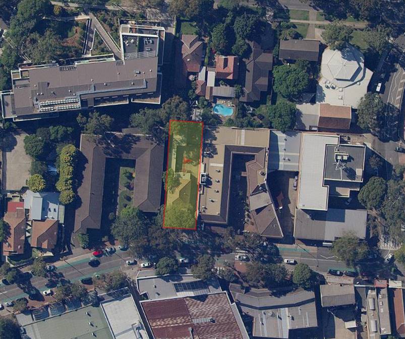
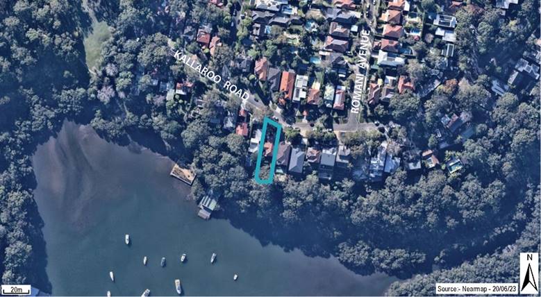
· Development Application DA23/26
· For the demolition of an existing two storey dwelling and
construction of a two-storey dwelling house including an internal 4
car-stacker garage and a swimming pool.
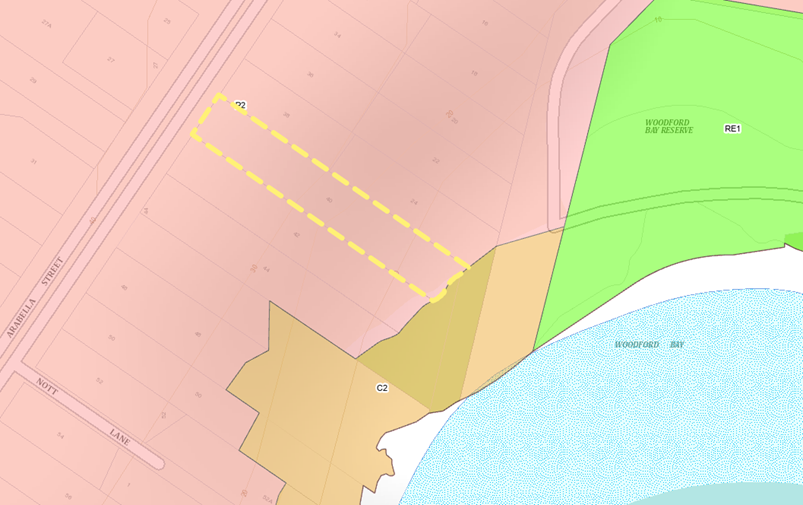
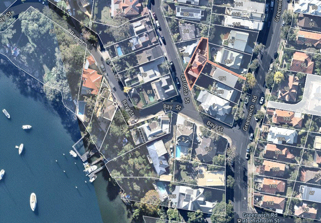
· On 40 Arabella Street, Longueville
-
subject to the following conditions:
PART A – GENERAL CONDITIONS
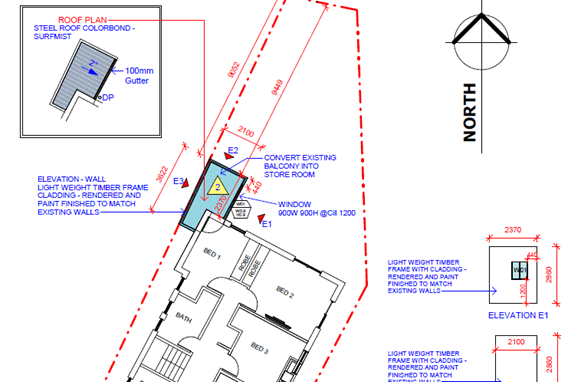
1. A.1 -
Approved plans
Development must be carried out in accordance with the following
approved plans (stamped by
Council), except where the conditions of this consent
expressly require otherwise.
|
Plan No
|
Revision
|
Plan Title
|
Drawn By
|
Dated
|
|
DA.301
|
C
|
Ground Floor Plan (Street)
|
Madeleine Blanchfield Architects
|
6/7/23
|
|
DA.304
|
B
|
Lower Ground Floor 01 Plan
|
Madeleine Blanchfield Architects
|
6/7/23
|
|
DA.307
|
B
|
Lower Ground Floor 02 Plan
|
Madeleine Blanchfield Architects
|
6/7/23
|
|
DA.310
|
B
|
Lower Ground Floor 03 Plan (Garden)
|
Madeleine Blanchfield Architects
|
6/7/23
|
|
DA.313
|
C
|
Roof Plan
|
Madeleine Blanchfield Architects
|
6/7/23
|
|
DA.318
|
B
|
Driveway Plan
|
Madeleine Blanchfield Architects
|
6/7/23
|
|
DA.401
|
B
|
North Western (Street) Elevation
|
Madeleine Blanchfield Architects
|
6/7/23
|
|
DA.402
|
C
|
North Eastern Elevation – Sheet
1/3
|
Madeleine Blanchfield Architects
|
6/7/23
|
|
DA.403
|
C
|
North Eastern Elevation – Sheet
2/3
|
Madeleine Blanchfield Architects
|
6/7/23
|
|
DA.405
|
C
|
South Eastern (Rear) Elevation
|
Madeleine Blanchfield Architects
|
6/7/23
|
|
DA.406
|
C
|
South Western Elevation – Sheet
1/3
|
Madeleine Blanchfield Architects
|
6/7/23
|
|
DA.407
|
C
|
South Western Elevation – Sheet 2/3
|
Madeleine Blanchfield Architects
|
6/7/23
|
|
DA.501
|
C
|
Longitudinal Section 01 – Sheet
1/2
|
Madeleine Blanchfield Architects
|
6/7/23
|
|
DA.502
|
C
|
Longitudinal Section 01 – Sheet
2/2
|
Madeleine Blanchfield Architects
|
6/7/23
|
|
DA.503
|
C
|
Longitudinal Section 02 – Sheet
1/2
|
Madeleine Blanchfield Architects
|
6/7/23
|
|
DA.504
|
C
|
Longitudinal Section 02 – Sheet
2/2
|
Madeleine Blanchfield Architects
|
6/7/23
|
|
DA.505
|
B
|
Cross Section 03
|
Madeleine Blanchfield Architects
|
6/7/23
|
In the event of any inconsistency between the approved plans and a
condition of this consent, the condition prevails.
Reason: To ensure all parties are aware of the approved plans and
supporting documentation that applies to the development.
2. A.2 - Design
amendments
Before the issue of a construction certificate, the certifier must
ensure the approved construction certificate plans (and specifications)
detail the following required amendments to the approved plans and supporting
documentation stamped by Council.
Planning Officer Amendment:
· 1:50 detail of the northern elevation privacy screen is to be
provided prior to construction to ensure the angle, width of battens and gaps
between obscure any overlooking between the subject development and the
adjoining property of 38 Arabella Street.
Bushland Officer Amendments:
· Tree 14 and Tree 14 (two mature fern trees) shown in the amended
landscape plan prepared by Studio IZ are to be transplanted to the south-east
section of the site to compliment the adjacent bushland at Woodford Bay
reserve. The transplant is to be shown in the revised landscape plan.
-
· Tree 3 Syzygium sp. Shown in the amended landscape plan prepared
by Studio IZ is to be replaced with a 3-meter tree selected from the
Council’s approved landscaping list of recommended plantings (LCC DCP
appendix 1 Part J). This tree is to be incorporated into the revised
landscape plan.
-
· The sediment control plan is to include the following amendments;
-
- The
use of 2500mm long metal star pickets hammered into the ground 500mm deep
(leaving 2000mm above ground) with 1000mm centres (spacing between each star
picket).
- Metal
wire threaded through each star picket to assist in taking the sediment load
between the centers.
- Use
of self-supporting geo textile semi permeable fabric allowing water to pass
through but catching sediment.
- Geo
textile semi permeable fabric to be installed 300mm deep into the ground and
1500mm above ground attached to star pickets and wire.
- A
secondary sediment fence to be installed following the specifications as
above 2000mm behind the first fence creating a secondary barrier.
- A
clear marking on the amended sediment control plan of the discharge path and
discharge point
Tree Officer Amendments:
· Three (3) 400L Angophora costata (Sydney Red Gum) trees are to be
replanted in recompense for the removal of three (3) significant gum trees at
the rear of the site adjoining bushland that died within a very short
timeframe, consistent with herbicide application (TPO Work Authority
TRP211201723 dated 23/12/21 approved)
Reason: To require minor amendments to the approved plans and
supporting documentation following assessment of the development.
3. A.3 - Payment
of security deposits
Before the commencement of any works on the site, or the issue of
a construction certificate, the applicant must make the following payments to
Council and provide written evidence of these payments to the Certifier:
|
1)
Security deposit
|
2)
Revision
|
|
3)
Infrastructure
Damage Bond
|
4)
$4000.00
|
The payments
will be used for the cost of:
· making
good any damage caused to any council property (including street trees) as a
consequence of carrying out the works to which the consent relates,
· completing
any public work such as roadwork, kerbing and guttering, footway
construction, stormwater drainage and environmental controls, required in
connection with this consent, and
Note: The inspection fee includes
Council’s fees and charges and includes the Public Road and Footpath
Infrastructure Inspection Fee (under the Roads Act 1993). The amount
payable must be in accordance with council’s fees and charges at the
payment date.
Note: Council inspection fees are
calculated in accordance with Council’s fees and charges at the payment
date.
Note: Required Council inspections for
civil works involving Council assets are to be carried out prior to the
pouring of any concrete (formwork) and on completion of the construction. An
initial site meeting is to be conducted with council and the contractor prior
to the commencement of any of the above works to allow for discussion of
Council construction / set out requirements.
The following
items are to be inspected:
· proposed
stormwater drainage improvements;
· proposed
stormwater connection to existing Council pit in the street;
· all
footpath, kerb/gutter and landscaping works; and
· any
adjustment works in Council’s Road reserve.
Reason: To
ensure any damage to public infrastructure is rectified and public works can
be completed.
4. A.4 - Payment
of building and construction industry long service levy
Before the issue of a construction certificate, the applicant is
to ensure that the person liable pays the long service levy of $5,050.00 as calculated at the date of this
consent to the Long Service Corporation or Council under section 34 of the Building
and Construction Industry Long Service Payments Act 1986 and provides
proof of this payment to the principal certifier.
Reason: To
ensure the long service levy is paid.
5. A.7.L - Tree
preservation and approved landscaping works
The protection of trees in Lane Cove is regulated under the State
Environmental Planning Policy (Biodiversity and Conservation) 2021 (SEPP)
parts 2.2 and 2.3 which prohibits the clearing of vegetation without the
authority conferred by a permit granted by Council. Clearing under the SEPP
is defined as:
a) cut down, fell, uproot, kill, poison, ringbark, burn, or
otherwise destroy the vegetation, or
b) lop or otherwise remove a substantial part of the
vegetation.
The clearing of trees or vegetation protected by the regulation is
an offence against the Environmental Planning and Assessment Act 1979 (NSW).
The maximum penalty that may be imposed in respect to any such
offence is $1,100,000 per individual and $5, 500,000 per corporation.
The
following trees shall be retained:
|
Tree No.
|
Species
|
Location
|
Dimension (metres)
|
|
2
|
Callistemon citrinus
|
Council verge
|
3 x 3
|
|
4
|
Syzygium spp
|
Front of property
|
14 x 4
|
|
5
|
Lagerstroemia indica
|
42 Arabella
|
5 x 4
|
|
13
|
Viburnum spp
|
38 Arabella
|
6 x 2
|
|
17
|
Phoenix canariensis
|
42 Arabella
|
8 x 4
|
|
18
|
Camellia sasanqua
|
42 Arabella
|
4 x 2
|
|
19
|
Cyathea australis
|
42 Arabella
|
4 x 2
|
|
20
|
Cinnamomum camphora
|
Rear 40 Arabella
|
10 x 10
|
|
21
|
Cyathea australis
|
Rear 40 Arabella
|
3 x 3
|
This
consent gives approval for the removal of the following trees:
|
Tree No.
|
Species
|
Location
|
Dimension (metres)
|
|
1
|
Callistemon citrinus
|
Council verge
|
3 x 3
|
|
3
|
Syzygium spp
|
Front of property
|
3 x 1
|
|
6
|
Camellia sasanqua
|
Side of property
|
3 x 1
|
|
7
|
Magnolia denudata
|
Side of property
|
3 x 2
|
|
8
|
Tibouchina granulosa
|
Side of property
|
5 x 2
|
|
9
|
Mangifera indica
|
Side of property
|
6 x 3
|
|
10
|
Mangifera indica
|
Side of property
|
6 x 3
|
|
11
|
Camellia sasanqua
|
Rear of property
|
3 x 1
|
|
12
|
Camellia sasanqua
|
Rear of property
|
3 x 1
|
|
14
|
Cyathea australis
|
Rear of property
|
5 x 3
|
|
15
|
Cyathea australis
|
Rear of property
|
5 x 3
|
|
16
|
Michelia figo
|
Rear of property
|
7 x 3
|
This
consent gives approval to carry out the following works in Tree Protection
Zones:
|
Tree No.
|
Species
|
Location
|
Works permitted within TPZ
|
|
4
|
Syzygium spp
|
Front of property
|
- Demolition of existing dwelling
-construction of new dwelling and stormwater
|
|
5
|
Lagerstroemia indica
|
42 Arabella
|
- Demolition of existing structures whilst keeping
retaining walls, construction of new dwelling
|
|
13
|
Viburnum spp
|
38 Arabella
|
- Demolition of existing pool
-construction of ancillary elements
|
|
17
|
Phoenix canariensis
|
42 Arabella
|
- demolition of existing pool
- Construction of landscape elements
|
|
18
|
Camellia sasanqua
|
42 Arabella
|
- Demolition of existing structures whilst keeping
retaining walls, construction of new dwelling
|
|
19
|
Cyathea australis
|
42 Arabella
|
- Demolition of existing structures whilst keeping
retaining walls, construction of new dwelling
|
|
20
|
Cinnamomum camphora
|
Rear 40 Arabella
|
- Construction of retaining walls
|
Tree removal may only occur upon issue of a Construction
Certificate.
Reason: To ensure the protection of trees to be retained and to
confirm trees removed for pruning/removal.
6. A.9.T - Works
on Council land
A separate application shall be made to Council’s Urban
Services Division for any associated works on Council property. Written
approval is to be obtained prior to the start of any works on Council
property.
Reason: To manage impacts to Council’s assets.
7. A.10.E -
Drainage plan amendments
Before the issue of a construction certificate, the certifier must
ensure the approved construction certificate plans (and specifications)
detail the following required amendments to the approved stormwater drainage
plans:
1. This
DA requires 12000 litre of rainwater tank. The detailed design for this
proposed system is required
2. Proposed
drainage system should show pipe sizes and invert levels up to the connection
point; confirming pipe system satisfies part O of Council’ storm water
DCP.
3. The
stormwater requirements shown in Basix certificate shall be included in
stormwater management plan and satisfied.
4. Clean
out pits are required at all low points of charged drainage line if charged
pipe system is proposed.
5. Sediment
control fence shall be placed around the construction site and shown in plan
6. Subsoil
seepage agg-line drainage is required around proposed garage front wall,
lower ground front wall and retaining wall or as it is necessary and
connected to proposed drainage system
7. The
proposed connection pit at start of dispersal trench shall be modified into a
pollution control pit (as shown in section 3.4.1 in part O of Council’s
stormwater DCP) with mesh (RH3030) and sump(300mm minimum). These details shall
be shown in plan.
8. Minimum
of 1.8m height difference is required between start and end of the charged
pipe system as per section 5.1 in Council DCP if charged system is used. The
details of design level difference shall be shown in plan.
9. The proposed rainwater reuse system with a
minimum effective capacity of 12,000 litres and to be installed in accordance
with Section 7.3 in Council’s Stormwater DCP and relevant Australian
standards. This tank shall have 100mm air gap on top and 100mm sludge zone at
the bottom.
10. Only
roof water shall be connected to rainwater tank.
11. The
rainwater tank shall show top water level, overflow path detail, pump system
and dimensions.
12. The
proposed basement shall be constructed with water-proof walls around it.
13. For
properties adjacent to bushland approval is required from Council’s
Coordinator Bushland on the design of the dispersal system to ensure the
health and vitality of trees and vegetation are retained.
14. The
installation of the dispersal trench shall be parallel to existing contour
lines.
15. The
proposed dispersal system shall be moved down stream side of the building and
pool by minimum 3.0m and shall be marked in stormwater plan as per section
5.2 of Council DCP. In this case, the arborist report shall be amended
covering all trees around the dispersal trench area
16. The
dispersal trench shall be similar to the typical section shown in Appendix 7
in part O of Council’s stormwater DCP and comply with Part H of
Council’s Bushland protection DCP
17. Installation
of pipe system and dispersal trench near the protected trees must be assessed
by Council Tree Officer
Certification
from a suitably qualified engineer as to the matters below is to be provided
to the Principal Certifying Authority, prior to the issue of any CC:
a) Compliance with
the amendments detailed in this condition.
b) Compliance with
Part O: Stormwater Management of Council’s DCP.
Where a
variation is sought, written approval is to be obtained from Council’s
Urban Services Division.
Reason: To
ensure adequate stormwater management in accordance with Council’s DCP.
8. A.12 –
Construction Certificate
The submission of a Construction Certificate and its issue by
Council or Principal Certifier PRIOR TO CONSTRUCTION WORK commencing.
Reason: To ensures the detailed construction plans and specifications comply
with the requirements of the Building Code of Australia (BCA) and any relevant
Australian Standard.
9. A.13 –
Swimming pool fence
A swimming
pool fence is to comply with the following:
a) That forms a barrier between the
swimming pool; and
i. any residential building or
movable dwelling situated on the premises; and
ii. any place (whether public or
private) adjacent to or adjoining the premises; and
b) That is designed, constructed and
installed in accordance with the standards as prescribed by the Regulations
under the Swimming Pools Act, 1992, and the Australian Standard AS1926
– 2012, “Swimming Pool Safety”.
SUCH FENCE IS TO BE
COMPLETED BEFORE THE FILLING OF THE SWIMMING POOL.
ADVICE:
In accordance with the Swimming Pools Amendment Act 2012, the swimming pool or spa is required to be registered on the NSW
Government State wide Swimming Pool Register when completed.
The register can be found at www.swimmingpoolregister.nsw.gov.au.
Reason: Statutory
requirement.
10. A.15 – Pool filter
and pump
The filter
and pump are to be located in a soundproof enclosure. If noise generated as a
result of the development results in an offensive noise Council, may prohibit
the use of the unit, under the provisions of the Protection of the
Environment Operations Act 1997.
Reason: Statutory requirement.
11. A.16 – Pool
warning notice
In
accordance with the requirements of the Swimming Pools Act 1992 and
Regulations thereunder a warning notice is to be displayed in a prominent
position in the immediate vicinity of the swimming pool at all times.
The notice must be in accordance with the standards of the
Australian Resuscitation Council for instructional posters and resuscitation
techniques and must contain a warning "YOUNG CHILDREN SHOULD BE
SUPERVISED WHEN USING THIS POOL".
Reason: Statutory requirement.
12. A.17 – Special
Condition – Prepurchase of Replacement Trees
The applicant is to provide receipt of pre purchased trees from a
registered nursery that will attain the prescribed height of replacement
trees as part of this consent. Purchased trees must also be of the nominated
pot size conditioned as part of this consent. The receipt is to be provided
to Council’s Landscape and Tree department prior to the issue of a
construction certificate. Purchased trees are to be grown in accordance with
specifications outlined within AS2303:2018 Tree Stock for Landscape Use.
Reason: To ensure replacement trees are at appropriate size upon
completion of the development.
PART B
– PRIOR TO DEMOLITION WORKS
13. B.1.T - Demolition
Traffic Management Plan
As a result of the site constraints, limited vehicle access and
parking, a demolition traffic management plan (DTMP) and report shall be
prepared by a Transport for NSW accredited person and submitted to and
approved by Council prior to commencing any demolition work.
The DTMP must:-
a) Make provision
for all construction materials to be stored on site, at all times.
b) Specify
construction truck routes and truck rates. Nominated truck routes are to be distributed
over the surrounding road network where possible.
c) Provide for the
movement of trucks to and from the site, and deliveries to the site.
Temporary truck standing/ queuing locations in a public roadway/ domain in
the vicinity of the site is not permitted unless a Works Zone is approved by
Council.
d) Include a
Traffic Control Plan prepared by an RMS accredited ticket holder for any
activities involving the management of vehicle and pedestrian traffic.
e) Specify that a
minimum seven (7) days notification must be provided to adjoining property
owners prior to the implementation of any temporary traffic control measures.
f) Include a
site plan showing the location of any site sheds, location of requested Work
Zones, anticipated use of cranes, structures proposed on the footpath areas
(hoardings, scaffolding or temporary shoring) and extent of tree protection
zones around Council Street trees.
g) Take into
consideration the combined construction activities of other development in
the surrounding area. To this end, the consultant preparing the DTMP must
engage and consult with developers undertaking major development works within
a 250m radius of the subject site to ensure that appropriate measures are in
place to prevent the combined impact of construction activities. These
communications must be documented and submitted to Council prior to work
commencing on site.
h) Be prepared in
accordance with relevant sections of Australian Standard 1742 –
“Manual of Uniform Traffic Control Devices”, RMS’s Manual
– “Traffic Control at Work Sites”.
Reason: To ensure public safety and minimise any impacts to the
adjoining pedestrian and vehicular traffic systems.
14. B.2.E - Asbestos
removal, handling and disposal
The removal, handling, and disposal of asbestos from building
sites shall be carried out in accordance with the requirements of the
Occupational Health and Safety Act and the Regulations. Details of the method
of removal in accordance with this condition is to be submitted to the
Principal Certifier and Council’s Environmental Health Section,
prior to commencing any demolition works.
Reason: To ensure worker and public health and safety.
15. B.3.EH - Compliance with
demolition standard
Demolition of buildings and structures must comply with Australian
Standard AS 2601—2001: The Demolition of Structures.
Reason: Prescribed condition under the EP&A Regulation 2021.
16. B.4.EH - Demolition work
plan the name, address, contact details and licence number of the Demolisher
/ Asbestos Removal Contractor.
- Details
of hazardous materials (including asbestos).
- Method/s
of demolition (including removal of any asbestos).
- Measures
and processes to be implemented to ensure the health & safety of workers
and community.
- Measures
to be implemented to minimise any airborne dust and asbestos.
- Methods
and location of disposal of any hazardous materials (including asbestos).
- Other
relevant details, measures and requirements to be implemented.
- Details
of re-use, recycling and disposal of waste materials.
- Date
the demolition works will commence.
Reason: To
ensure health and safety.
17. B.13.L - Project
Arborist
Prior to the commencement of any works, including demolition, a
Project Arborist of minimum Australian qualitative framework (AQF) Level 5
qualification, is to be appointed to oversee/monitor trees/condition
compliance during the construction process. A letter of engagement must be
provided to Council prior to issue of a construction certificate. Compliance
certificates must be available upon request, submitted to the Principal
Certifier within five days of site attendance and must be available to
council immediately upon request prior to the issue of an occupation
certificate; failure to produce the latest certificate will be considered
a breach of conditions. Each compliance certificate must contain
photographic evidence to confirm site attendance. A compliance certificate is
required for each of the following phases.
The project
Arborist shall:
· Certify
all tree protection measures listed within Part B prior to demolition
works
· Clearly identify
and tag trees which are to be removed and which trees are to be retained as
part of this consent
· Oversee the
demolition of the existing carport whilst retaining the existing retaining
wall within the TPZ of trees 5, 18 and 19.
· Oversee the
excavation of stormwater and installation of landscape elements within the
TPZ of Tree 13
· Oversee any
excavation within the TPZ of T17 including proposed planting
· Provide
quarterly health and condition assessments on protected trees
· Statement upon
completion for the development that all retained trees have been maintained
in a healthy, viable condition and replacement planting has been undertaken.
The statement must also recommend remedial advice for trees post construction
to mitigate and long-term construction impacts.
Reason: To
ensure trees are protected and retained on the site.
18. B.14 – Special
Condition – Tree Protection Measures Fencing
The following tree protection measures must be in place prior to
demolition works and certified by the project arborist.
Tree Protection Fencing must be installed within the following
locations:
1. Along the area marked within the tree protection plan on page
32 of the Arborist Report by Laurence and Co. dated 13th March 2023
The fencing must consist of a 1.8 m high chain mesh fence held in
place with concrete block footings and fastened together. An example of
fencing is shown under figure 3 on page 16 of the Australian Standard
4970-2009 The Protection of Trees on Development. The fenced area shall not
be used for the storage of building materials, machinery, site sheds, or for
advertising and the soil levels within the fenced area shall remain
undisturbed.
A waterproof sign must be placed on every second panel stating,
‘NO ENTRY TREE PROTECTION AREA – this fence and sign are not
to be removed or relocated for the work duration.’ Minimum
size of the sign is to be A3 portrait with NO ENTRY TREE PROTECTION ZONE in
capital Arial Font size 100, and the rest of the text in Arial font size 65.
Such fencing and signage must be erected Prior to Demolition
including site preparation and remain in place for the duration of the
construction work
Movement of Tree Protection Fencing must be overseen and approved
by the project Arborist with notification provided to Council’s Tree
Management Officer in writing.
Reason: To protect the natural environment.
PART C -
BEFORE THE ISSUE OF A CONSTRUCTION CERTIFICATE
19. C.1 - Construction site
management plan
Prior to any demolition works and before the issue of a
construction certificate, the applicant must ensure a construction site
management plan is provided to and approved by the principal certifier. The
plan must include the following matters:
· location
and materials for protective fencing and hoardings to the perimeter on the
site.
· provisions
for public safety
· pedestrian
access, including disabled and pram access, is to be maintained throughout
the course of the construction as per AS-1742.3, ’Part 3 - Traffic
control devices for works on roads’
· pedestrian
and vehicular site access points and construction activity zones
· details
of construction traffic management, including proposed truck movements to and
from the site and estimated frequency of those movements, and measures to
preserve pedestrian safety in the vicinity of the site. The construction
traffic management plan shall comply with the requirements of Part R of Lane
Cove DCP 2010 and shall be submitted to Council’s Traffic Section for
written approval. Consultation with NSW Police, TfNSW, and Sydney Buses may
be required. Note: Heavy vehicles are not permitted to travel on local roads
without Council approval.
· protective
measures for on-site tree preservation (including in accordance with AS
4970-2009 Protection of trees on development sites and Council’s DCP,
if applicable) and trees in adjoining public domain (if applicable)
· For
major works, appointment of a project arborist of minimum AQF Level 5
qualification to oversee/monitor tree(s) condition during the construction
process.
· details
of any bulk earthworks to be carried out
· location
of site storage areas and sheds
· equipment
used to carry out all works
· a
garbage container with a tight-fitting lid
· dust,
noise and vibration control measures including a construction noise
management plan prepared in accordance with the NSW EPA’s Interim Construction
Noise Management Guidelines by an appropriately qualified acoustic
consultant.
· location
of temporary toilets.
The applicant must ensure a copy of the approved construction site
management plan is kept on-site at all times during construction.
Council
Approvals
1. Where
hoarding is required to be provided along the street frontage, a Hoarding
Application is to be submitted to Council for approval.
2. Any
construction plant on the public road reservation requires an approved
“Application for standing plant permit”.
Additional
Council Requirements
1. Stockpiles
or soil shall not be located on / near any drainage lines or easements,
natural watercourses or water bodies, footpath or roadway without first
providing suitable protective measures adequate to protect these water
bodies.
2. All
stockpiles of contaminated materials must be stored in an environmentally
sensitive manner in a secure area on the site and shall be suitably covered
to prevent dust and odour nuisance.
Reason: To require details of measures that will protect the
public, and the surrounding environment, during site works and construction.
20. C.2 - Erosion and
sediment control plan
Prior to any demolition works or clearing of any vegetation and
before the issue of a construction certificate, the applicant is to ensure
that an erosion and sediment control plan is prepared in accordance with the
following documents before it is provided to and approved by the principal
certifier:
· Council’s
development control plan,
· the
guidelines set out in the NSW Department of Housing manual ‘Managing
Urban Stormwater: Soils and Construction Certificate’ (the Blue Book),
and
· the
‘Do it Right On-Site, Soil and Water Management for the Construction
Industry' (Southern Sydney Regional Organisation of Councils and the Natural
Heritage Trust).
The applicant must ensure the erosion and sediment control plan is
kept on- site at all times during site works and construction.
Reason: To ensure no substance other than rainwater enters the
stormwater
system
and waterways
21. C.5 - Dilapidation
report
Before the issue of a construction certificate, a suitably
qualified engineer must prepare a dilapidation report detailing the
structural condition of adjoining buildings, structures or works, and public
land, to the satisfaction of the certifier. If the engineer is denied access
to any adjoining properties to prepare the dilapidation report, the report
must be based on a survey of what can be observed externally and demonstrate,
in writing, to the certifier’s satisfaction that all reasonable steps
were taken to obtain access to the adjoining properties.
Reason: To establish and document the structural condition of
adjoining properties and public land for comparison as building work
progresses and is completed.
22. C.24.E - Structural
engineer’s details
The Construction Certificate plans and specifications must include
detailed professional structural engineering plans and/or specifications for
the following:
· underpinning;
· retaining
walls;
· footings;
· reinforced
concrete work;
· structural
work;
· upper-level
floor framing;
and where
relevant in accordance with any recommendations contained in an approved
geotechnical report.
Reason: To
ensure structural adequacy.
23. C.25.E - Construction
methodology report
Where there are structures on neighbouring properties that are
deemed to be in the zone of influence of the proposed excavations, a suitably
qualified engineer must prepare a Construction Methodology Report
demonstrating that the proposed excavation will have no adverse impact on any
surrounding property and infrastructure.
The report must:
· be submitted to
the Principal Certifying Authority prior to issue of any Construction
Certificate;
· include a
geotechnical report to determine the design parameters appropriate to the
specific development and site;
· include
recommendations on appropriate construction techniques to ameliorate any
potential adverse impacts.
· this shall
include traffic management plan as well as storage and manoeuvring areas,
impacts on public assets and appropriate remedial works on Council assets.
The development works are to be undertaken in accordance with the
recommendations of the Construction Methodology report.
Reason: To protect neighbouring buildings.
24. C.27.E - Proposed
vehicular crossing
The vehicular crossing servicing the property shall be constructed
prior to the issue of the Occupation Certificate. The existing driveway shall
be completely demolished and apart from the area of the new driveway shall be
reinstated by standard kerb and gutter satisfying Council’s standard.
The new driveway shall be designed and complied with Council’s standard
drawing No: CIV.4.2, 3.1 and 3.2.
a) The proposed vehicular crossing shall be constructed to the
specifications and levels issued by Council. The applicant has to lodge
Vehicular Crossing Application form and pay application fee as shown in this
form to get these levels. This shall be done prior to Construction
Certificate.
b) The driveway opening width along at the face of kerb is to be
no wider than 5.5.
c) The driveway shall be setback a minimum 300mm away from any
existing power pole and stormwater pit.
d) Certification is to be provided by a suitably qualified
engineer demonstrating compliance with AS 2890 Series including AS
2890.1.2004 “Off Street Car Parking”, and Council's standards and
specifications.
e) The excavation for driveway near Council tree and construction
shall satisfy Council’s Tree preservation Officer.
f) The following plans shall be prepared and certified by a
suitably qualified engineer:
· Longitudinal
sections along the extreme wheel paths of the driveway/access ramp at a scale
of 1:20 demonstrating compliance with the scraping provisions of AS2890.1.
The sections shall include details of all levels and grades, including those
levels stipulated at boundary levels, both existing and proposed from the
centre line of the roadway through to the parking area clearly demonstrating
that the driveway complies with Australian Standards 2890.1-2004 - Off Street
Car Parking.
· Transitional
grades in accordance with AS2890. If a gradient in excess of 25% is proposed,
the engineer must certify that this design is safe and environmentally
sustainable
· Sections showing
the clearance to the underside of any overhead structure complies with the
clearance provisions of AS2890.1.
A ‘Construction of Residential Vehicular Footpath
Crossing’ application, design and certification shall be submitted to
the Principal Certifying Authority prior to the issue of the Construction
Certificate. All works associated with construction of the crossing shall be
completed prior to the issue of any Occupation Certificate.
Reason: To ensure the proposed vehicular crossing complies with
Australian Standards and Council’s requirements.
PART D -
BEFORE THE COMMENCEMENT OF BUILDING WORK
25. D.1 - Erosion and
sediment controls in place
Before the commencement of any site or building work, the
principal certifier must be satisfied the erosion and sediment controls in the
erosion and sediment control plan, (as approved by the principal certifier)
are in place until the site is rectified (at least 70% ground cover is
achieved over any bare ground on site).
Reason: To
ensure runoff and site debris do not impact local stormwater systems and
waterways.
26. D.3 - Signs on site
A sign must
be erected in a prominent position on any site on which building work or
demolition work is being carried out:
a) showing the
name, address and telephone number of the principal certifier for the work;
and
b) showing the name
of the principal contractor (if any) for any building work and a telephone
number on which that person may be contacted outside working hours; and
c) stating that
unauthorised entry to the work site is prohibited.
Any such sign
is to be maintained while any demolition or building work is being carried
out but must be removed when these works have been completed.
Note: This does not apply in relation to building work, or demolition
work, that is carried out inside an existing building that does not affect
the external walls of the building.
Reason:
Prescribed condition under section 70 of the EP&A Regulation 2021.
27. D.4 - Compliance with
the Home Building Act
In the case of residential building work for which the Home
Building Act 1989 requires there to be a contract of insurance in force
in accordance with Part 6 of that Act, that such a contract of insurance is
in force before any building work authorised to be carried out by the consent
commences.
Reason: Prescribed condition under section 69 of the EP&A
Regulation 2021.
28. D.5 - Home Building Act
requirements
Residential building work within the meaning of the Home Building
Act 1989 must not be carried out unless the principal certifier for the
development to which the work relates (not being Council) has given Council
written notice of the following information —
a) In the case of
work for which a principal contractor is required to be appointed -
i) the name and licence number of
the principal contractor, and
ii) the name of the insurer by
which the work is insured under Part 6 of that Act,
b) In the case of
work to be done by an owner-builder—
i) the name of the owner-builder,
and
c) if the
owner-builder is required to hold an owner-builder permit under that Act, the
number of the owner-builder permit.
If arrangements for doing the residential building work are
changed while the work is in progress so that the information notified
becomes out of date, further work must not be carried out unless the
principal certifier for the development to which the work relates (not being
the Council) has given Council written notice of the updated information.
Reason:
Prescribed condition under section 71 EP&A Regulation 2021.
29. D.6 - Notice regarding
dilapidation report
Before the
commencement of any site or building work, the principal certifier must
ensure the adjoining building owner(s) is provided with a copy of the
dilapidation report for their properties no less than 10 days before the
commencement of any site or building works and provide a copy of the report
to Council at the same time.
Reason: To
advise neighbours and Council of any dilapidation report.
PART E -
WHILE BUILDING WORK IS BEING CARRIED OUT
30. E.1 - Hours of work
The principal certifier must ensure that building work, demolition
or vegetation removal is only carried out between:
Monday to
Friday (inclusive) 7.00am
to 5.30pm
Saturday 7.00am
to 4.00pm
With NO high noise generating activities, to be undertaken after
12 Noon on Saturday.
All demolition, building construction work, including earthworks,
deliveries of building materials to and from the site to be restricted as follows:-
Monday to
Friday (inclusive) 7am
to 5.30pm
High
noise generating activities, including rock breaking and saw cutting be
restricted between 8am to 5.00pm with a respite period between 12.00 noon to
1.30pm Monday to Friday
Saturday 8am
to 12 noon
with NO
high noise generating activities, including excavation, haulage truck
movement, rock picking, sawing, jack hammering or pile driving to be
undertaken. Failure to fully comply will result in the issue of a breach of
consent P.I.N.
A Notice/Sign showing permitted working hours and types of work
permitted during those hours, including the applicant’s phone number,
project manager or site foreman, shall be displayed at the front of the site.
The principal certifier must ensure building work, demolition or
vegetation removal is not carried out on Sundays and public holidays, except
where there is an emergency.
Unless otherwise approved within a construction site management
plan, construction vehicles, machinery, goods, or materials must not be
delivered to the site outside the approved hours of site works.
Note: Any variation to the hours of work requires Council’s
approval.
Reason: To
protect the amenity of the surrounding area.
31. E.2 - Compliance with
the Building Code of Australia
Building work
must be carried out in accordance with the requirements of the Building
Code of Australia.
Reason:
Prescribed condition under section 69 of the EP&A 2021.
32. E.4 - Implementation of
the site management plans
While vegetation removal, demolition and/or building work is being
carried out, the applicant must ensure the measures required by the approved
construction site management plan and the erosion and sediment control plan
are implemented at all times.
The applicant must ensure a copy of these approved plans is kept
on site at all times and made available to Council officers upon request.
Reason: To ensure the required site management measures are
implemented during construction.
33. E.5 - Implementation of
BASIX commitments
While building work is being carried out, the applicant must
undertake the development strictly in accordance with the commitments listed
in the BASIX certificate submitted under this application.
Reason: To ensure BASIX commitments are fulfilled in accordance
with the BASIX certificate (prescribed condition under section 75 of the
EP&A Regulation 2021.
34. E.6 - Surveys by a
registered surveyor
While building work is being carried out, a registered surveyor is
to measure and mark the positions of the following and provide them to the
principal certifier —
a) All footings/
foundations
b) At other stages
of construction – any marks that are required by the principal
certifier.
Reason: To ensure buildings are sited and positioned in the
approved location
35. E.7 - Construction noise
While building work is being carried out where no noise and
vibration management plan is approved under this consent, the applicant is to
ensure that any noise caused by demolition, vegetation removal or works does
not exceed an LAeq (15 min) of 5dB(A) above background noise, when measured
at any lot boundary of the property where these works are being carried out.
Reason:
To protect the amenity of the neighbourhood.
36. E.8 - Tree protection
While site or building work is being carried out, the applicant
must maintain all required tree protection measures in good condition in
accordance with the construction site management plan required under this
consent, the relevant requirements of AS 4970-2009 Protection Of Trees on
Development Sites and any Arborist’s report approved under this
consent. This includes maintaining adequate soil grades and ensuring all
machinery, builder’s refuse, spoil and materials remain outside tree
protection zones.
Reason: To protect trees during construction.
37. E.9 - Responsibility for
changes to public infrastructure
While building work is being carried out, the applicant must pay
any costs incurred as a result of the approved removal, relocation or reconstruction
of infrastructure (including ramps, footpaths, kerb and gutter, light poles,
kerb inlet pits, service provider pits, street trees or any other
infrastructure in the street footpath area).
Reason: To ensure the payment of approved changes to public
infrastructure.
38. E.10 - Shoring and
adequacy of adjoining property (if applicable)
If the development involves any excavation that extends below the
level of the base of the footings of a building, structure, or work on
adjoining land (including any structure or work within a road or rail
corridor), the person having the benefit of the development consent must, at
the person’s own expense —
a) Protect and
support the building, structure or work from possible damage from the
excavation, and
b) Where necessary,
underpin the building, structure or work to prevent any such damage.
This condition does not apply if the person having the benefit of
the development consent owns the adjoining land or the owner of the adjoining
land has given consent in writing to that condition not applying.
Reason: Prescribed condition - EP&A Regulation clause 98E
39. E.12 - Cut and fill
While building work is being carried out, the principal certifier
must be satisfied all soil removed from or imported to the site is managed in
accordance with the following requirements:
a) All excavated
material removed from the site must be classified in accordance with the
EPA’s Waste Classification Guidelines before it is disposed of at an
approved waste management facility and the classification and the volume of
material removed must be reported to the principal certifier.
b) All fill
material imported to the site must be Virgin Excavated Natural as defined in
Schedule 1 of the Protection of the Environment Operations Act 1997
or a material identified as being subject to a resource recovery exemption by
the NSW EPA.
Reason: To ensure soil removed from the site is appropriately
disposed of and soil imported to the site is safe for future occupants.
40. E.15.B - Critical stage
inspections
Critical stage inspections are to be carried out in accordance
with Section 6.5 of the EP&A Act 1979 and sections 61, 63 and 65 of the Environmental
Planning and Assessment (Development Certification and Fire safety)
Regulation 2021.
Where Lane Cove Council is appointed as the principal certifier,
an inspection is to be booked for each of the following relevant stages
during the construction process:
a) underpinning;
b) retaining walls;
c) footings;
d) reinforced
concrete work;
e) structural work;
f) upper
level floor and roof framing; and
Reason:
EP&A Act requirement.
41. E.18.B - No obstruction
of public way
The public way and Council verge must not be obstructed by any
materials, vehicles, refuse, skips or the like, under any circumstances.
Non-compliance with this requirement will result in the issue of a notice by
Council to stop all work on site.
Reason: To
ensure public safety.
42. E.19.B –
Encroachments
1. No
portion of the proposed structure shall encroach onto adjoining properties.
2. The
proposed construction shall not encroach onto any existing
Council drainage pipe or easement unless approved by Council. If a Council
stormwater pipe is located at site during construction, Council is to be
immediately notified. Where necessary the drainage line is to be
reconstructed or relocated to be clear of the proposed building works.
Developer must lodge Stormwater Inspection Application form to Council. All
costs associated with the reconstruction or relocation of the drainage pipe
are to be borne by the applicant. Applicant is not permitted to carry out any
works on existing Council and private stormwater pipe lines without
Council’s approval.
3. No encroachment is to occur into public open space.
Reason: To
ensure works are contained wholly within the subject site
43. E.20.EH –
Stockpiles
Stockpiles of topsoil, sand, aggregate, spoil or other material
capable of being moved by water to be stored clear of any drainage line,
easement, natural watercourse, footpath, kerb or roadside.
Reason: To mitigate adverse environmental impacts on the
surrounding area.
44. E.25 – Special
Condition – Stockpiling of Materials
No
stockpiling of materials, building equipment or additional activities listed
in section 4.2 of AS4970-2009 The Protection of trees on Development Sites
is to occur within designated tree protection areas or on the Council
Owned Nature Strip. All building materials must be stored within the subject
site.
Reason: To
mitigate damage to Council land.
45. E.26 – Special
Condition – Installation of retaining walls within the TPZ of retained
trees
The installation retaining walls within the Tree Protection Zone
of retained trees must be done so using an isolated pier and beam method or
use existing footings under the supervision of the project arborist. No roots
greater than 30mm diameter are to be severed to facilitate the installation
of the piers. A 150mm buffer must be given to roots greater than 30mm
diameter. Roots less than 30mm diameter that conflict with the location of
piers must be documented by the Project arborist and pruned with a sharp
implement
Exposed roots shall be protected in accordance with section 4.5.4
of AS4970-2009 The protection of trees on Development Sites
Reason: To mitigate damage to retained trees.
46. E.27 – Special
Condition – Construction of side pathways and pavers
The new steppers within the Structural Root Zone of tree #5 and
#17 are to be installed entirely above grade. Permeable fill consisting of
20mm angular stone is to be required to level any undulating ground. A
geotextile fabric should then be used to separate the fill from a sand
bedding layer. Paving may then be placed on the layer of sand bedding. Level
depths of subbase are to be determined by the landscape company. Installation
of the side pathway within the TPZ of protected trees is to be overseen by
the project arborist.
Reason: To minimise unnecessary excavation within the Structural
Root Zone of retained trees.
47. E.28 – Demolition
of existing building and hard surfaces
The demolition of the northwestern side of the existing carport
within the Protection Zone of trees 5, 18 and 19 must be undertaken under the
supervision of the project arborist. Demolition of above ground structures
may be undertaken via machinery, with existing retaining wall bordering tree
5,18 and 19 is to be retained. Demolition must be undertaken from within the
footprint of the existing structures. No machinery within this area is
to be used below existing grade.
Reason: To protect the root system of retained trees.
48. E.29 – Special
Condition – Excavation for stormwater services
Excavation required for the installation of stormwater services
within the TPZ of all retained tree must be overseen by the project arborist.
Excavation is to be undertaken using hand tools only. No roots greater than
30mm diameter are to be severed as part of works. A 150mm buffer must be
given to roots greater than 30mm diameter at allow for future growth. Roots
less than 30mm diameter that conflict with services may be pruned by the
project arborist using a sharp handsaw and documented within the compliance
certificate.
Reason: To
protect retained trees during construction.
PART F -
BEFORE THE ISSUE OF AN OCCUPATION CERTIFICATE
49. F.1 - Works-as-executed
plans and any other documentary evidence
Before the
issue of the relevant occupation certificate, the applicant must submit, to
the satisfaction of the principal certifier, works-as-executed plans, any
compliance certificates and any other evidence confirming the following
completed works:
(a) All stormwater drainage systems and
storage systems
(b) The following matters that Council
requires to be documented:
· Compliance
with Part O - Stormwater Management of Lane Cove DCP 2010. Where a
variation is sought, written approval shall be obtained from Council’s
Urban Services Division.
· Compliance
with the requirements for waste and recycling, and bulky waste storage
room(s) set out in Part Q – Waste Management and Minimisation of
Lane Cove DCP 2010.
· Compliance
with AS-3500.
· Certification
from a suitably qualified engineer that the approved stormwater pipe system
and 12000 litre of rainwater tank system have been constructed in accordance
with the approved plans.
· Signed
plans by a registered surveyor clearly showing the surveyor’s details
and date of signature.
· Evidence
of removal of all redundant gutter and footpath crossings and reinstatement
of all kerbs, gutter, turfing and footpaths, to the satisfaction of
Council’s Urban Services Division.
· Certification
from suitable engineer that the swimming pool has been constructed satisfying
relevant Australian standards.
· Certification
from suitable licenced contractor that the all works have been constructed
satisfying relevant Australian standards.
· Certification
from qualified structural engineer that the proposed construction have been
completed according to approved plan and structurally satisfied
The principal
certifier must provide a copy of the plans to Council with the occupation
certificate.
Reason: To confirm the location of works once constructed that
will become Council assets.
50. F.2 - Completion of
public utility services
Before the issue of the relevant occupation certificate, the principal
certifier must ensure any adjustment or augmentation of any public utility
services required as a result of the development, is completed to the
satisfaction of the relevant authority. All costs associated with the
relocation or removal of services shall be borne by the applicant.
The certifier must request written confirmation from the relevant
authority that the relevant services have been completed.
Reason: To ensure required changes to public utility services are
completed, in accordance with the relevant agency requirements before
occupation.
51. F.3 - Post-construction
dilapidation report
Before the issue of an occupation certificate, a suitably
qualified engineer must prepare a post-construction dilapidation report, to
the satisfaction of the principal certifier, detailing whether:
a) after comparing
the pre-construction dilapidation report to the post- construction
dilapidation report required under this condition, there has been any
structural damage to any adjoining buildings; and
b) where there has
been structural damage to any adjoining buildings, that it is a result of the
building work approved under this development consent.
Before the issue of an occupation certificate, the principal
certifier is to provide a copy of the post-construction dilapidation report
to Council (where Council is not the principal certifier) and to the relevant
adjoining property owner(s).
Reason: To
identify damage to adjoining properties resulting from building work on the
development site.
52. F.4 - Preservation of
survey marks
Before the issue of an occupation certificate, a registered
surveyor must submit documentation to the principal certifier which
demonstrates that:
a) no existing
survey marks have been removed, damaged, destroyed, obliterated or defaced,
or
b) the applicant
has re-established any survey mark(s) that were damaged, destroyed,
obliterated or defaced in accordance with the Surveyor General’s
Direction No. 11 – Preservation of Survey Infrastructure.
Reason: To protect the State’s survey infrastructure.
53. F.5 - Repair of
infrastructure
Before the issue of an occupation certificate, the applicant must
ensure any public infrastructure damaged as a result of the carrying out of
building works (including damage caused by, but not limited to, delivery
vehicles, waste collection, contractors, sub-contractors, concreting
vehicles) is fully repaired to the written satisfaction of Council, and at no
cost to Council.
Note: If the council is not satisfied,
the whole or part of the security/bond submitted will be used to cover the
rectification work.
Reason: To ensure any damage to public infrastructure is
rectified.
54. F.6 - Removal of waste
upon completion
Before the issue of an occupation certificate, the principal
certifier must ensure all refuse, spoil and material unsuitable for use on
the site is removed from the site and disposed of in accordance with the
waste management plan. Written evidence of the removal must be supplied to
the satisfaction of the principal certifier.
Before the issue of a partial occupation certificate, the
applicant must ensure the temporary storage of any waste is carried out in
accordance with the approved waste management plan to the principal
certifier’s satisfaction.
Reason: To ensure waste material is appropriately disposed of or
satisfactorily stored.
55. F.13.EH - Outdoor
lighting
Outdoor lighting shall comply with Australian Standard AS
4282-1997 – Control of the obtrusive effects of outdoor lighting.
Where sites adjoin bushland, all outside lighting must be
appropriately baffled to minimise light pollution into the bushland area.
Native plantings may be used to absorb lighting.
Reason: To protect the amenity of nearby residential properties
56. F.19 – Special
Condition – Replacement planting
Trees that are removed must be replaced on a 1:1 ratio to comply
with provisions outlined within Part J Landscaping of the Lane Cove Council
Development Control plan 2010 unless otherwise stated within this consent.
The Trees shall be replaced with endemic tree species at 75 litre pot size,
selected from Councils DCP Part J – Landscape, Appendix 1 unless stated
otherwise within this consent.
The following additional trees are to be planted on top of what is
proposed under the approved landscape plan. These include:
· 3 x Tristaniopsis laurina “Luscious” (Water Gums) to
be planted on the Council Nature strip in front of the property at regular
intervals. These trees are to be planted from a minimum 100L pot size.
-
· 3 x Angophora costata (Sydney Red Gum) to be planted in the
grassed area below the proposed pool and retaining walls adjoining 24
Woodford Street. These trees are to be planted from a minimum container size
of 400L, with a minimum spacing of 5m from each other.
-
-
Trees must be installed and signed off by the
project arborist Prior to the issue of an Occupation Certificate.
Reason: To ensure replacement planting.
57. F.20EH – Special
Condition – Landscape practical completion report
A landscape practical completion report must be prepared by the
consultant landscape architect and submitted to Council or the accredited
certifier within 7 working days of the date of practical completion of all
landscape works. This report must certify that all landscape works have been
completed in accordance with the landscape working drawing. A copy of the
report must be submitted to Council PRIOR TO THE ISSUE OF THE OCCUPATION
CERTIFICATE.
Reason: To ensure the completion of all landscape works.
58. F.21EH – Special
Condition – Evidence of Maintenance
Prior to issue of the Certificate of Occupation, the applicant
must submit evidence of an agreement for the maintenance of all site landscaping
by a qualified horticulturist, landscape contractor or landscape architect,
for a period of 12 months from the date of issue of the Certificate of
Occupation.
Reason: To ensure the landscape works are maintained.
59. F.22EH – 12 Month
Maintenance Agreement
At the completion of the landscape maintenance period, the
consultant landscape architect/ designer must submit a final report to
Council or the accredited certifier, certifying that all plant material has
been successfully established, that all of the outstanding maintenance works
or defects have been rectified prior to preparation of the report and that a
copy of the 12-month landscape maintenance strategy has been provided to the
Owner/ Occupier. The report must include site images, showing the
establishment of the replacement trees chosen by Council. A site inspection
by the Council Arborist may be required to ensure acceptable tree
establishment. A copy of the report must be submitted to Council.
Reason: To ensure the ongoing health and vitality of the plants
during the establishment period.
PART H -
OCCUPATION AND ONGOING USE
60. H.1 - Release of
securities / bonds
When Council receives an occupation certificate from the principal
certifier, the applicant may lodge an application to release the securities
held in accordance with Condition (2). Council may use part, or all of the
securities held to complete the works to its satisfaction if the works do not
meet Council’s requirements.
Reason: To allow release of securities and authorise Council to
use the security deposit to complete works to its satisfaction.
61. H.4 – Maintenance
of wastewater and stormwater treatment device
During occupation and ongoing use of the building, the applicant
must ensure all wastewater and stormwater treatment devices (including
drainage systems, dispersal trench, rainwater tank and swimming pool) are
regularly maintained, to remain effective and in accordance with any positive
covenant.
Reason: To satisfy Council’s engineering requirements. To
protect sewerage and stormwater systems.
|